Locate the cursor over the line of interest or EM 3, click on respective line or well to open.
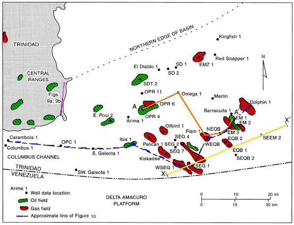
Figure 4. Columbus Basin and the island of Trinidad showing wells used in this study and location of major oil and gas fields. Cross section AA' and seismic line XX' are shown in Figures 7 and 5, respectively. Outcrop photographs are shown in Figures 9a and 9b.