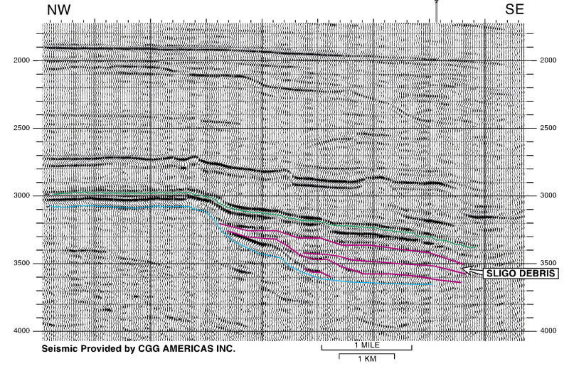
Figure 14--Three-dimensional (3-D) seismic line B showing the nature of exploration opportunity in Sligo fore-reef and slope. Line is located on Figure 3. The sequence boundary of Goldhammer et al. (1991) within the upper Sligo is identified in blue. Red lines identify downslope debris intervals seaward of the Sligo margin. These stratigraphic intervals commonly display onlap and downlap terminations. Compare with the 3-D seismic line of Figure 9 and the two-dimensional data of Figure 4 that also show the same sequence boundary and the Sligo debris. The top Pearsall reflector is indicated by green.