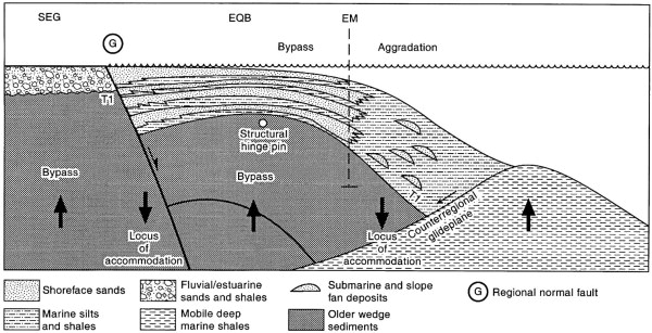
Figure 12. Illustration of a single lower Pleistocene megasequence deposited across the Southeast Galeota (SEG), East Queen's Beach (EQB), and East Mayaro (EM) areas between the JLS (T1) and the HLS (top surface). This sequence includes many of the hydrocarbon productive sands of East Mayaro field and is bounded in the proximal direction by the G fault (G) and in the distal direction by a lower Pleistocene counterregional surface moving along a mobile shale body located northeastward of the EM1 and EM2 wells (Figure 4).