POINT BAR DEPOSITIONAL AREAS
RELATED TO SEDIMENTARY STRUCTURES
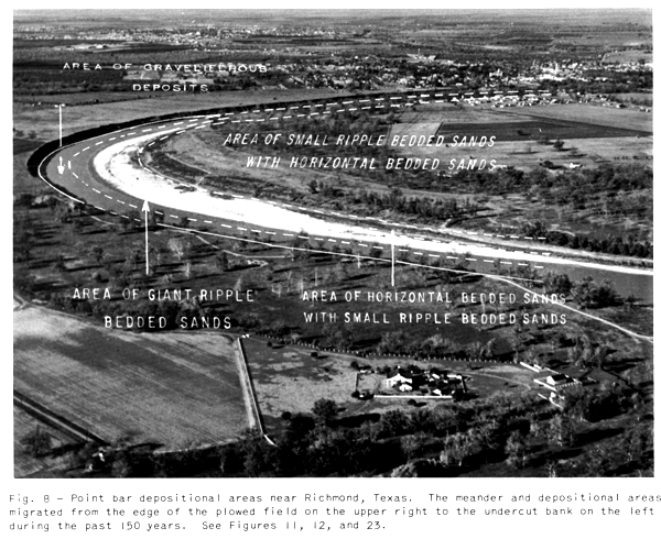
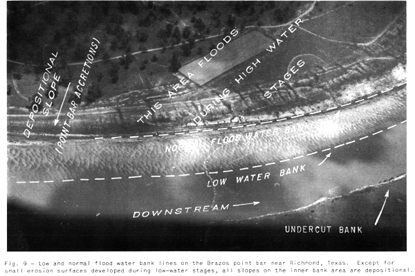
Topographically, the point bar environment may be subdivided into four arcuate-shaped depositional areas (Figure 8) of different, but relative elevations related to river stages (Figure 9) and also of different, but relative, positions within the meander loop related to distances from the undercut bank. Sedimentary structures and grain-size characters diagnostic of each depositional area are, from highest to lowest.
1) Area of small-ripple bedded, mainly poorly sorted, very fine- to fine-grained sands interbedded with thinner "horizontally" bedded, fine-grained sands and thin clay layers.
2) Area of "horizontally" bedded, mainly well-sorted, fine- to medium grained sands interbedded with thinner small-ripple bedded, well- to poorly sorted, very fine- to medium-grained sands
3) Area of giant-ripple bedded, mainly well-sorted, fine- to coarse grained,occasionally graveliferous sands
4) Area of poorly bedded and poorly sorted, coarse- to very coarse grained sands and gravel deposits.Note The above sedimentary features, grain size, and sorting variations are principally those of the point bar deposits within the first Brazos River meander loop southeast of Richmond, Texas. Grain sizes vary for point bar deposits up and downstream and also for different southeast Texas streams; however, the relative grain size and sorting differences of each point bar area are similar to the above.
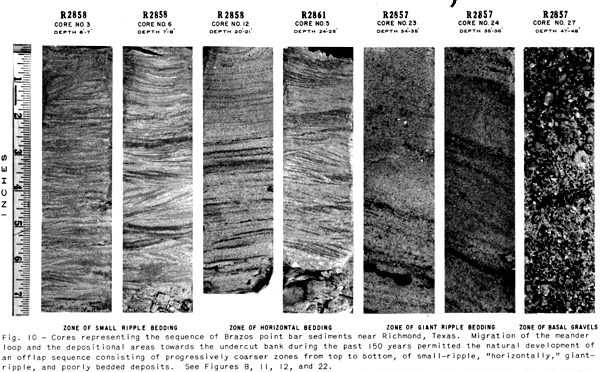
Individual depositional features are of
diagnostic value, but the sequence and association of deposits
and features are probably the most important criteria for
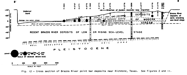
recognizing point bar deposits. Vertical sections in borings (Figure 10) near Richmond consist of offlap sequences (Figures 11 and 12)
repeating the grain size and sorting variations and sedimentary
features which are diagnostic of the four depositional areas.
Migration of the meander loop and these areas of deposition
towards the undercut bank permits the natural development of a
point bar stratigraphic sequence consisting, from the top
downward, of progressively coarser deposits (1) small ripple
bedded, (2) "horizontally" bedded, (3) giant-ripple
bedded, and (4) poorly bedded.
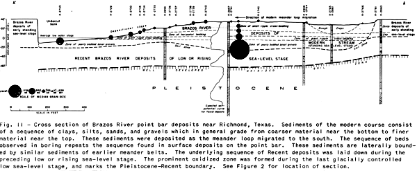
Point bar sediments comprise the coarser alluvial sediments occur
ring within stream meander belts which trend usually at right
angles to the regional depositional strike. The majority of
directional features of point bar sediments are directed towards
and aligned at right angles to the con temporaneous regional
shorelines of gradually subsiding basins
Area of Poorly Bedded
and Poorly Sorted Graveliferous Sands
Poorly bedded and poorly sorted, coarse-grained deposits are
typical of the depositional area comprising only the crossover
channels and the basal part of the depositional slope which
occurs mainly within the low-stage channel (see Figures 8, 9, and 10) A
poor form of graded bedding is not uncommon in these deposits. In
the downstream sections of the alluvial plains of coastal
southeast Texas streams, these graveliferous sediments form the
basal sections of point bar sequences. The lack of bedding might
be attributed to the high degree of turbulence, large velocity
variations of river currents, and also to the coarse-grained
nature of the sediments of this part of the channel.
Area of Giant-Ripple Bedded Sands
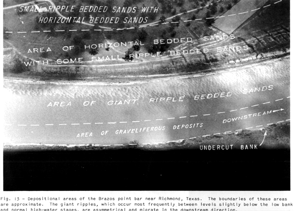
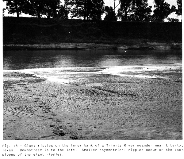
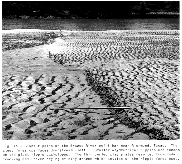
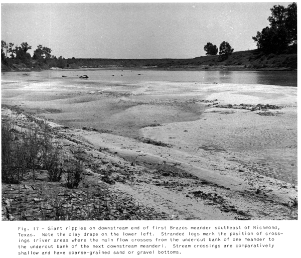
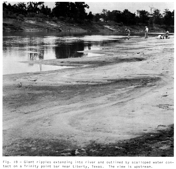
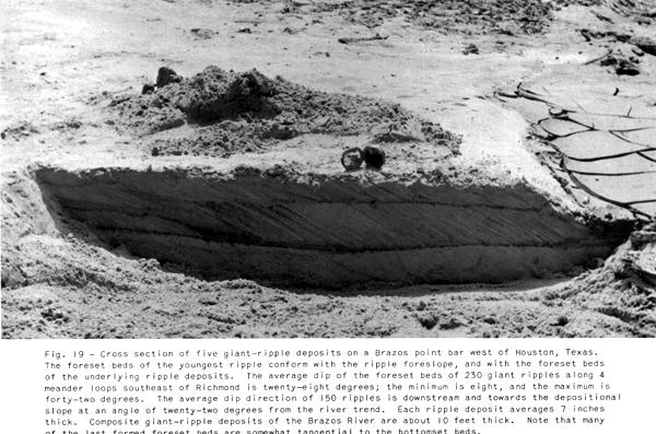
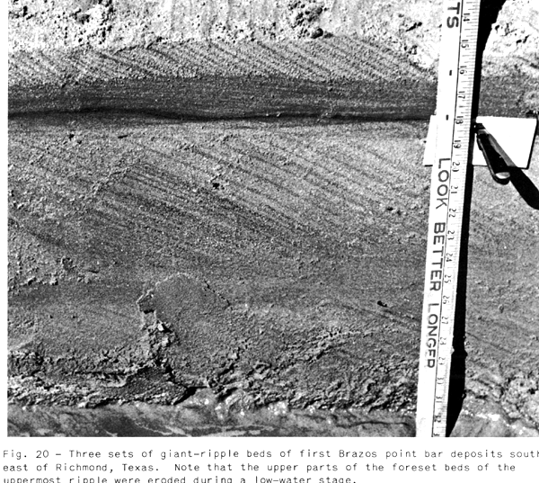
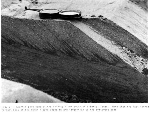
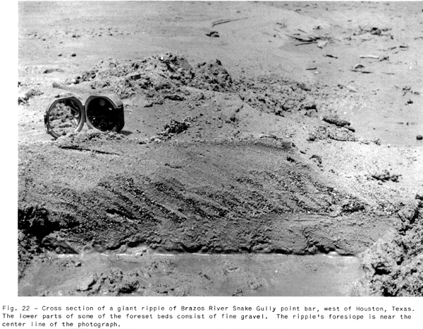
The area of giant-ripple bedded (Figure 13), mainly well-sorted, fine- to coarse-grained, occasionally graveliferous sands, includes that part of the depositional slope immediately above the area of poorly bedded deposits. Giant asymmetrical ripples (Figures 13, 14, 15, 16, 17, & 18), the typical depositional forms on this part of the slope, occur in most cases between the level of normal high-water stages and a level a few feet below low-water stage. The ripples are aligned nearly normal to the river trend and each ripple migrates downstream over the underlying ripple and associated deposits. Sedimentary features associated with these ripples are typical of the crossbedding described as torrential bedding, continuous-incline bedding, diagonal-incline bedding, etc. (see Figures 19, 20, 21, & 22). The association between foreset bedding of "mammoth" ripples and the familiar cross-bedding so common in many coarse sandstone beds has been recognized by Kindle (1917). Because this zone of paint bar deposition also migrates in the direction of the undercut bank, a vertical section (approximately 10 feet thick for the Brazos River near Richmond) of giant-rippled deposits is laid down on top of the basal, poorly bedded point bar sediments.
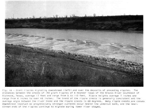
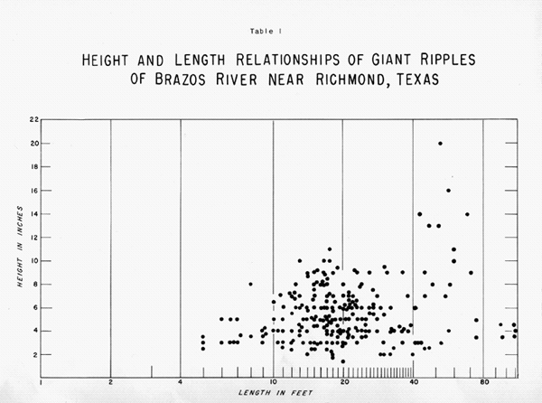
Numerous giant ripples on the first four Brazos River point bars southeast of Richmond, Texas, have been measured (see Table 1). The heights of 150 ripples averaged 7 inches and the distances between ripple crests averaged 17 feet. Ripple foreslopes are steep and face downstream; backslopes are very gentle and slope upstream. Foreset dips of 230 ripples ranged from eight to forty-two degrees and averaged twenty-eight degrees. Only a few low-angle dips were measured; approximately 82 percent of the dips varied between twenty-two and thirty-six degrees. Usually the foreset beds which form during the final falling river stages have smaller dips and are tangential to the associated bottomset beds and also to the topset beds of the underlying ripple (see Figures 19 and 21). The upper parts of the foreset beds of many giant ripples are destroyed. The top and bottomset beds are very thin and have an average upstream dip of two degrees
Crests of many giant ripples may be traced for
distances of over 150 feet from the normal flood level bank to
the low-stage bank and into the river to depths of over 4 feet.
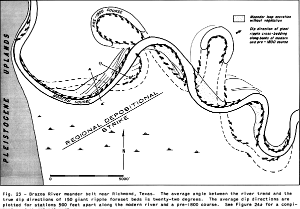
Crests of 150 ripples form an average downstream angle of
sixty-eight degrees with the bank. Thus, the direction of maximum
dip of the foreset beds of most ripples is directed downstream
towards the depositional bank at an angle of twenty-two degrees
from the river trend (Figure
23). The vertical thickness of any one
set of ripple foreset beds is approximately 7 inches.
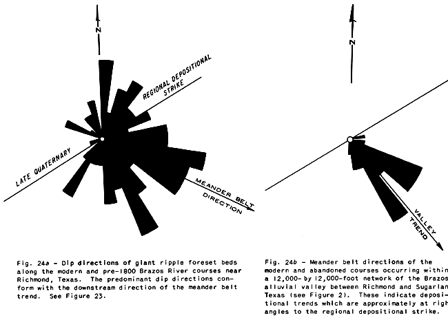
The predominant dip directions of giant-ripple foreset beds along
the inner banks of twelve meander loops of the modern course, and
a reconstructed pre-1800 course of the Brazos River near Richmond
conform with the downstream direction of the meander belt trend (Figure 24a). These directions should also be related to marine
shoreline directions, since meander belt trends parallel valley
trends which, in most cases, are approximately at right angles to
the regional depositional strike of gradually subsiding
depositional basins (see Figures 1, 3, and 24b).
Giant ripples and related cross beds of similar proportions have
been recognized by Kindle (1917) in tidal channel deposits of
eastern Canada, but the directions of the foreset dips at any one
locality change with the tides. Perhaps the cross-bedded nature
of Kindel's tidal channel deposits is typical of the herringbone
structure of Shrock (1948).
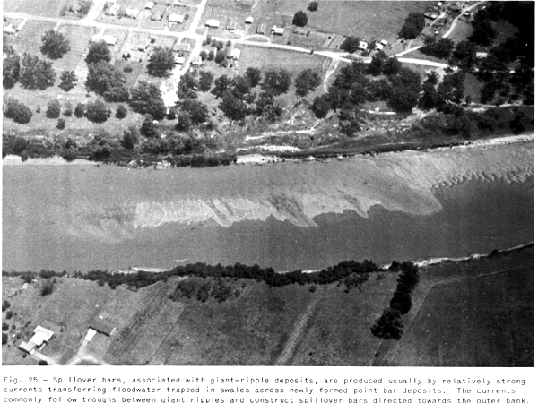
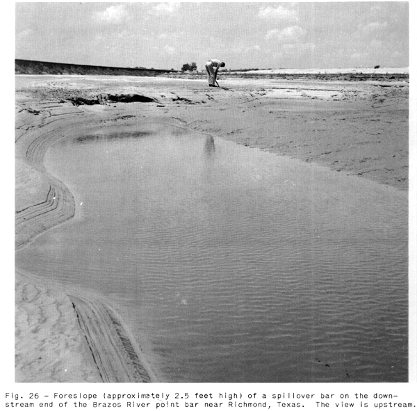
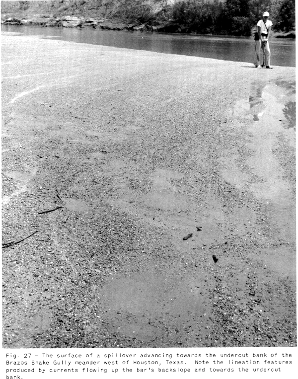
Spillover bars (Figures 25, 26, & 27) deposited by strong local currents transferring flood
waters which were trapped in swales, across lower elevations of
giant-ripple bar accretions, are common in the upstream and down
stream ends of the point bar. Although much larger, spillover
bars are somewhat similar to the associated giant ripples.
Heights of the foreslopes of Brazos River spillover bars are
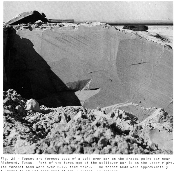
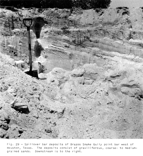
usually over 3 feet. Fore set beds (Figures 28 and 29)
conform to the bar foreslopes and have an average dip of
twenty-eight degrees. Most dip directions are downstream;
however, directions towards the undercut bank are common. The
topset and bottomset beds are thicker than those of the giant
ripples, and may be either "horizontally" bedded or
small-ripple bedded.
Area of
'Horizontally' Bedded Deposits
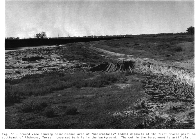
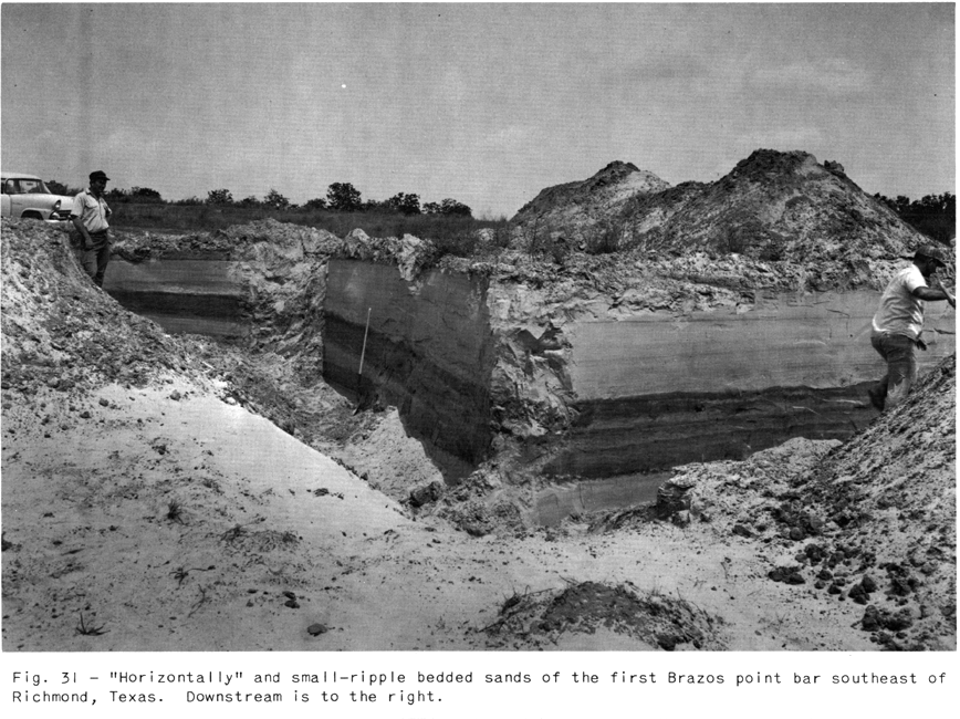
The point bar area (Figures 8, 13, and 30) of
"horizontally" bedded, usually well-sorted, fine- to
medium-grained sands, interbedded with thinner small-ripple
bedded, mainly well-sorted, very fine- to medium-grained
sands,occurs above the area of giant-ripple bedded sands (see
Figures 31 and 32). The area is subject to flooding during high-water and
flood stages, but the area does not include the uppermost part of
the point bar which is only subject to flooding during maximum
flood stages
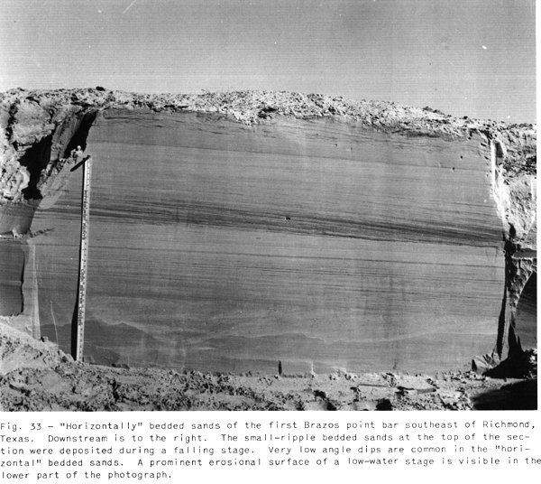
Most of the deposits are horizontally laminated in contrast to
the sedimentary structures of the other point bar deposits, but
low initial dips and extremely low-angle cross--laminations are
the more common depositional attitudes and features of the
"horizontal" beds (Figures 33 and 34).
Numerous horizontal laminae have been traced continuously in cuts
(Figure 31) over 100 feet long, parallel and at right angles to
the river channel. These laminated sediments settled from
suspension over large areas or were bed-load materials deposited
by laminar currents. Laminae composed of dark heavy mineral
grains, approximately equal in size to quartz grains of
associated laminae, are common and suggest a very delicate
adjustment of the stream's capacity to winnow and transport
quartz grains and deposit heavier minerals. Laminae of heavy
minerals could be described as "lag" concentrates.
Numerous laminae are composed of finely divided plant fragments
and mica; some laminae are rich in shell fragments of land snails
and reworked but well-preserved Upper Cretaceous Foraminifera.
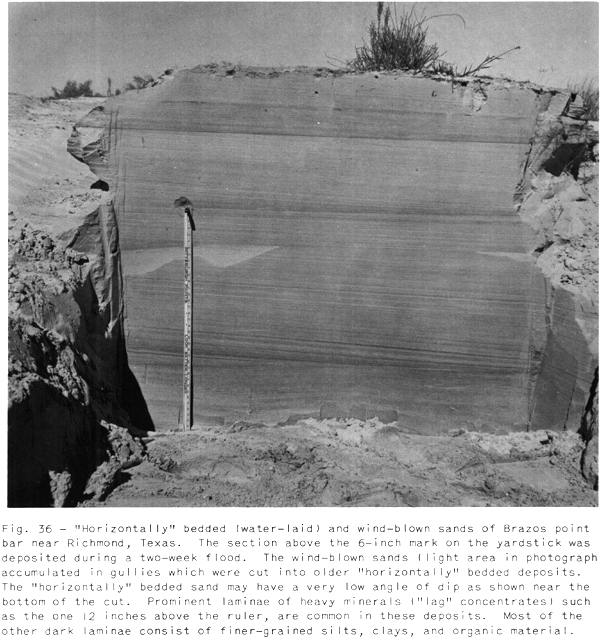
Wind-blown sands (Figure
35) are in a few places interbedded
with water-laid, horizontally laminated sands (Figure 36).
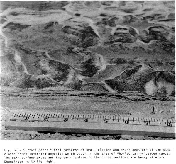
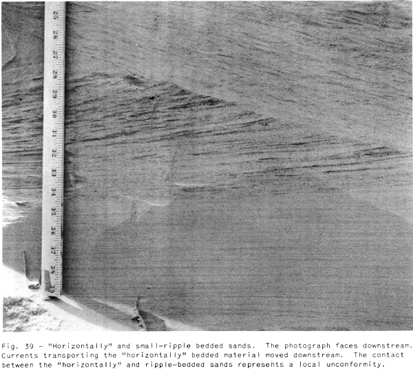
The small-ripple bedded (cross-laminated) deposits (Figures 37, 38 and 39)
which are seldom over 24 inches thick, comprise the foreset,
topset, and bottomset beds of migrating, small-scale,
asymmetrical ripples; Small-ripple sediments are deposited during
rising and falling stages in relatively slack water near the
inside bank where currents are usually loaded with sediment.
Although these deposits are interbedded with the horizontally
bedded sediments they are more characteristic of the uppermost
paint bar sediments
The average dip of the small-ripple foreset beds is twenty-seven
degrees Most dip directions are downstream; directions towards
and away from the undercut bank are not uncommon, but upstream
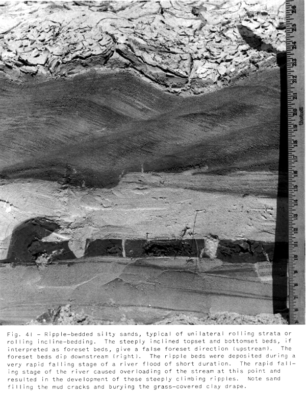
dips are rare. Steeply climbing small-ripple structures (Figures 40 and 41)
develop when currents are overloaded These structures have been
described as unilateral rolling strata, rolling inclined bedding,
and change rolls (see Pettijohn, 1949). The top- and bottomset
beds of such ripples may give a false foreset dip direction
upstream if the bottom- and topset beds are interpreted as
foreset beds.
Cross-bedded spillover bar features frequently develop in the zone of "horizontally" bedded sands.
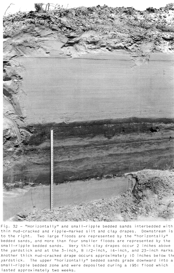
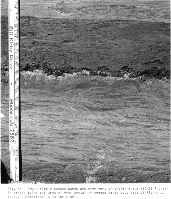
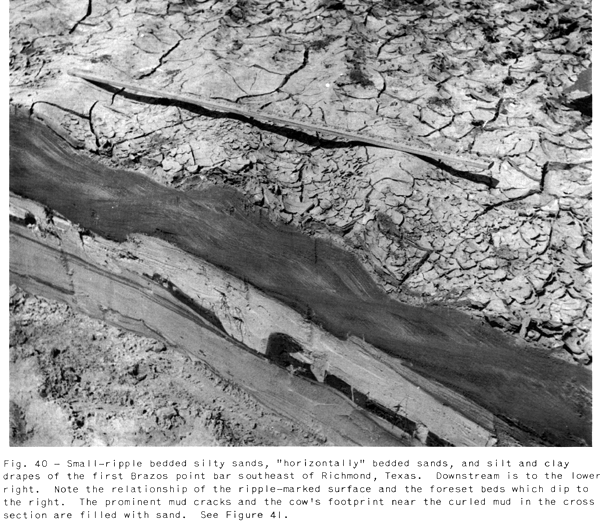
Thin beds of ripple-marked, finely laminated silt-clay layers, in many cases mud-cracked, are interbedded in many areas with the "horizontally" and small-ripple bedded sands (see Figures 42 and 43).
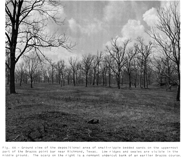
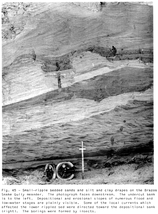
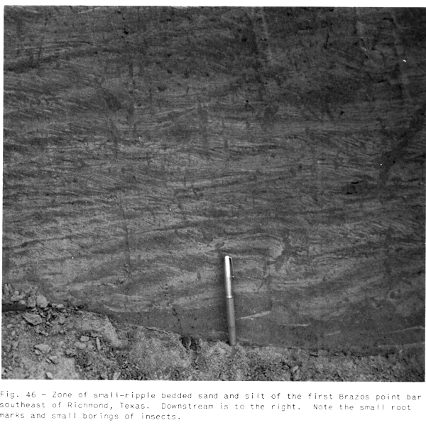
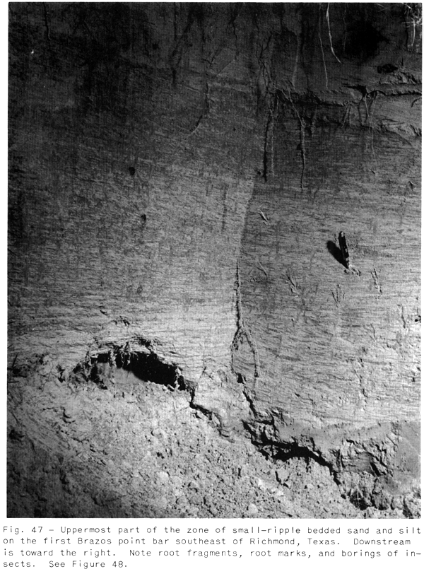
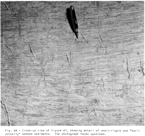
Area of Small-Ripple
Bedded Fine Sands
The area of small-ripple bedded, usually poorly
sorted, very fine to fine-grained sands interbedded with thinner
beds of "horizontally' bedded fine-grained sand occupies the
uppermost part of the point bar area which is subject to flooding
only during extreme high-water and flood stages (Figures 8 and 44).
The ripple bedding is similar to the small-ripple bedding of the
area of "horizontally" bedded sands; however, the scale
is usually smaller (Figures 45, 46, 47, and 48).
"Horizontally" bedded sands are present and are more
common on the ridges and less common in the swales. Silt and clay
beds are more common in the swales.
The small-ripple bedding is the predominant feature of this area
inasmuch as this part of the point bar is flooded usually by
relatively slack flood water which is overloaded with
finer-grained sediments.