ALLUVIAL PLAIN ENVIRONMENTS
The
classification, description, and distribution of the alluvial
plain and other depositional environments, such as deltaic,
interdeltaic, marine, etc. of the northern Gulf coastal plains
have been discussed in considerable detail by R. J. LeBlanc
(1950). The alluvial plains of the Gulf Coast rivers consist of
two principal environments: (a) stream meander belt, and (b)
floodbasin or backswamp.
A stream meander belt is the zone within which a stream
constantly shifts its course by undercutting one bank and
depositing sediment on the opposite bank. Most streams develop
and abandon several courses or meander belts, which form the
highest topographic features of alluvial valleys.
A flood basin is the topographically low area between meander
belts or between a meander belt and the valley wall. These areas
are overflow basins for slack river water during flood stages. A
typical alluvial valley is characterized by several meander belts
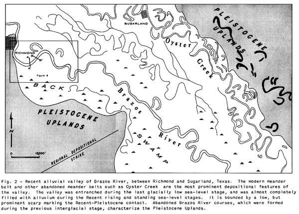
and intervening flood basins (see Figure 2).
River meander belt deposits comprise the coarser
"trains" of alluvial sediments since the river
constantly reworks and winnows its own deposits. The coarser
materials are repeatedly transported for short distances down
stream and are redeposited. Most of the finer-grained sediments
are transported further distances downstream and to the adjacent
backswamps during high water or flood stages. Flood basins are
the main depositional sites of the finer grained river alluvium.
Meander Belt Environments
The meander belt consists of
several distinct subenvironments: (a) point bar, (b) natural
levee, (c) abandoned channel, and (d) cutoff meander or oxbow
lake
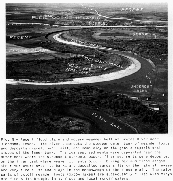
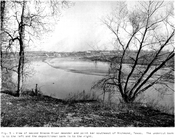
Point bar environment. The point bar* environment (Figures 3, 4, and 5) includes the depositional areas
encircled by the outer bank of a river meander. It is the site of
most active deposition within the alluvial valley
Cross profiles of meander loop channels are asymmetrical. The
thalweg (axis of greatest channel depth) occurs near the outer
bank, which is steep and subject to much undercutting and
slumping. On the cross-channel profile, the river bed rises
gently from the thalweg towards the inner bank. The gentle slope
of the inner bank is depositional in contrast to the under cut
outer bank which is erosional (see Figure 3)
River crossings are channel areas between successive meanders
where the main current crosses the channel from the undercut bank
of one meander to the undercut bank of the next downstream
meander. The river at the crossings is considerably shallower
than near the concave bank of a meander. Its cross channel
profile is somewhat u-shaped.
Migration of the channel of a meander loop results from scouring
and undercutting of the outer bank and deposition on the inner
bank, and produces a series of arcuate accretionary bar ridges
and swales (sloughs, lakes, and chutes) within the point bar
area. These features record stages in development of the point
bar. The depositional bank slopes gently from the youngest
prominent ridge towards the thalweg, but small ridges may cause
minor undulations of this slope. The relief of the arcuate swell
and swale features of the inner area of the meander loop varies
in elevation from low to flood-stage levels. However, most of
this area is flooded only during maximum river stages.
Natural levees Natural levees are very low,
asymmetrical ridges which flank the flood-stage channel of a
stream. The crest of the natural levee is near the channel, and
the levee slopes gently toward the backswamps. The width of the
natural levee is from 60 to over 700 times its height. The height
varies with the size of the stream; Mississippi natural levees
are approximately 15 feet high and Brazos levees are about 5 feet
high Natural levees consist of very fine sands9 silts, and clays
which are deposited by channel overflow waters. Coarser materials
are deposited on the levee crest, and progressively finer
materials on the levee backslopes and in flood basins. Although
soil development and vegetation destroy much of the bedding' very
small ripple lamination is common in natural levee deposits
Natural levees within stream meander belts, together with the
higher point bar deposits' form alluvial ridges which are the
highest parts of alluvial valleys.
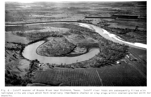
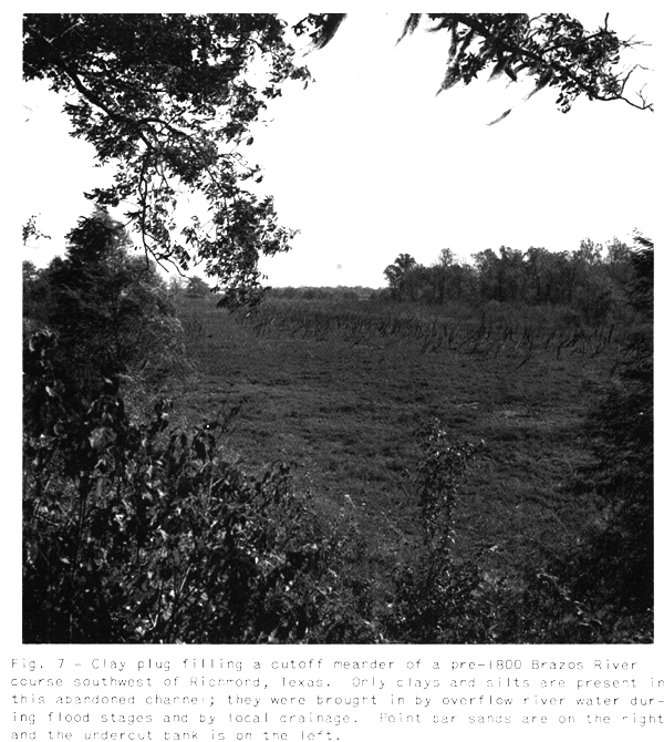
Abandoned channels
cutoff meanders, and channel plugs. Abandoned channels such as Oyster
Creek (Figure 2), formed by major upstream river
diversions and also cutoff meanders (Figures 6 and 7) are subsequently filled with finer
clastic materials, mainly thin-bedded and laminated clays, silt,
and organic matter. These channel fillings are collectively
called channel plugs. Cutoff meander fillings, also called clay
plugs, may form crescent-shaped impermeable barriers within
meander belt sands. Cutoff meanders containing clay plugs are
more common in well-developed meander belts; compare the poorly
developed modern Brazos and the well-developed Oyster
Creek-Brazos meander belts (Figure 2). However, the size and areal
distribution of clay plugs and meander belt sands vary with the
size of the stream. Nanz (1956) and the New Orleans Area staff
have pointed out that fine "rained channel fillings may form
impermeable barriers which influence hydrocarbon accumulations in
Cretaceous alluvial deposits of the Wisner field, Franklin
Parish, Louisiana
![]()
*Areas
within the channels of river meander loops are called points by
Mississippi river boat captains since these are points of land
and submerged bars projecting across the general trend of river
traffic.
![]()