Click on image to enlarge.
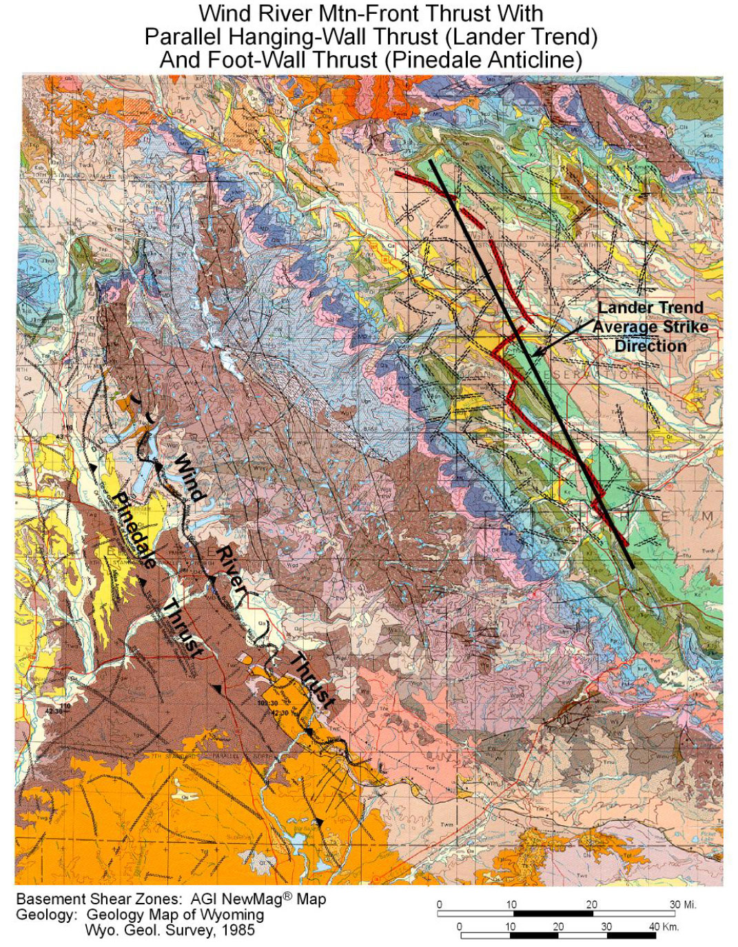
Figure 23. A section of the geologic map of Wyoming illustrating how the Pinedale thrust occurs just in front of, and parallel to, the Wind River thrust. On the back side of the Wind River thrust block is the Lander trend, which was previously shown in Figures 5 and 6. Here I highlight the underlying basement faults of the Lander trend, which the thrust closely follows. This thrust is not exactly parallel to the Wind River Range, although individual segments of it are. (Why: I don’t know yet.)