Click on image to enlarge.
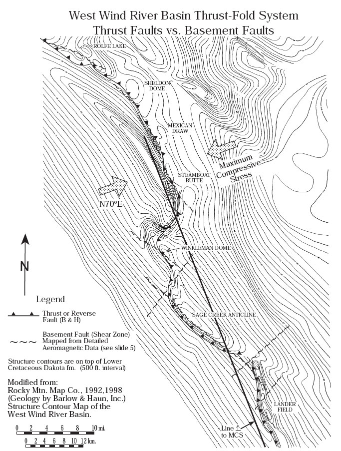
Figure 6. The basement faults/shear zones highlighted in red in Figure 5 correspond exactly to the winding, mapped thrust fault extending from Rolfe Lake field on the north to Lander field on the south. This involves four basement faults approximately perpendicular to maximum compressive stress and three cross faults. This example lends credibility to the interpretation that basement faults underlie the sand bars in the Powder River Basin where there is no independent verification of the existence of faults. (Note that not all basement faults become reactivated, at least not to the extent that fault movement can be detected on subsurface maps.)