The Booch Gas Play in Southeastern Oklahoma*
By
Dan T. Boyd1
Search and Discovery Article #10100 (2006)
Posted February 25, 2006
*Adapted from presentation to Tulsa Geological Society, February 14, 2006. This topic, by the author, is presented in Oklahoma Geological Survey publication SP2005-1 and is entitled “The Booch Gas Play in Southeastern Oklahoma: Regional and Field-Specific Petroleum Geological Analysis” (http://www.ogs.ou.edu/pubs.php), It is also the topic of the final Booch workshop to be held November 1, 2006, at the Moore-Norman VoTech, with a field trip November 8-9. The homepage for the Oil and Gas group in the Survey is http://www.ogs.ou.edu/fossilfuels/oilgas.php.
![]() Click
to view presentation in PDF format.
Click
to view presentation in PDF format.
1Oklahoma Geological Survey ([email protected])
Abstract
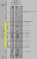
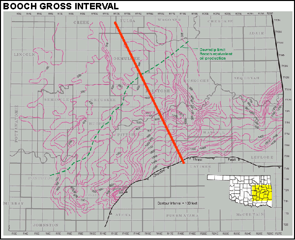
The Booch stratigraphic interval produces natural gas in Oklahoma from the Arkoma Basin and the southern part of the Cherokee Platform. It is defined in the subsurface as stratigraphically equivalent to the lower three quarters of the lower Desmoinesian (Middle Pennsylvanian) McAlester Formation. The Booch is composed of eight, northerly sourced progradational sequences bounded by flooding surfaces. Although the cyclicity observed may have a eustatic component, it is thought that local variations in sediment influx and subsidence, mostly through sediment loading, were the primary factors driving changes in sea level.
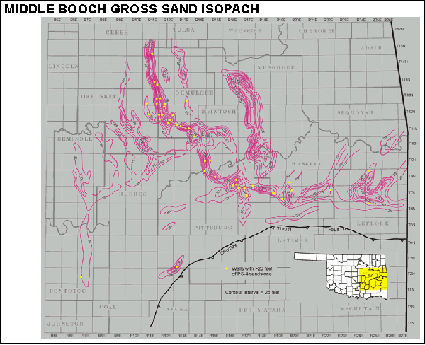
On well logs each of the eight parasequences exhibit a distinct coarsening upward profile as the environment of deposition progressed from distal marine, to delta front, to delta plain, to, in some cases, incised valley. The depositional environments represented by the sandstone reservoirs that occur at the top of Booch parasequences include distributary-mouth bars, tidal channels, distributary channels, over bank (crevasse) splays, and/or multistoried channel-fills (incised valleys). Because the deltas feeding into the basin at this time were tidally dominated, the longshore movement of sand was nonexistent. For this reason Booch exploration has concentrated on accurately tracing the paths taken by deltas as they prograded into the basin.
The Booch appears to be dominantly self-sourced, with its sandstone reservoirs charged by adjacent marine shales and coals. Although gas-prone source kerogen is abundant in these beds, these source rocks tend to be immature, causing most traps to be underfilled. Although production rates for Booch gas wells tend to be low compared with other reservoirs, its shallow depth and inexpensive drilling costs have made it a favorite target for Oklahoma operators in the current high-price environment.


Schematic Middle Booch depositional systems.
View in sequence Middle Booch gross sand isopach and depositional systems
Conclusions
-
Booch is not equivalent to McAlester.
-
Booch records eight progradational cycles (all sourced from the north).
Lower Booch (2 cycles) most marine and poorest producer.
Middle Booch (3 cycles) maximum progradation and best producer.
Upper Booch (3 cycles) intermediate.
-
Booch reservoirs are all sandstones (occurring near cycle tops).
-
Booch marine shales and coals are the dominant source rocks.
-
Migration is largely short-distance.
-
Stratigraphy is the key to economic entrapment.