PSRecognition of Tectonic Events in the Conformation of Structural Traps in the Eastern Oriente Basin, Ecuador*
By
Hugo Belotti1, José Silvestro1, Gustavo Conforto1, Miguel Pozo1, Jorge Erlicher1, Jorge Rodriguez1, and Eduardo Rossello2
Search and Discovery Article #30019 (2003)
*Adapted for online presentation from poster session presented at the AAPG Convention, Salt Lake City, Utah, May, 2003.
1PeCom, Neuquén, Argentina (Gustavo Conforto -- [email protected])
2Conicet, University of Buenos Aires, Argentina
Editorial Note: This article, which is highly graphic (or visual) in design, is presented as: (1) three posters, each represented by a PDF image, which contains the usual enlargement capabilities; and (2) searchable HTML text with figure captions linked to corresponding illustrations with descriptions.
Users without high-speed internet access to this article may experience significant delay in downloading some of the PDF files due to their sizes.
Click on individual poster below, to view it in PDF format.
|
|
The Oriente Basin in Ecuador (Figure1-1) may be divided into two different physiographic-structural domains. The moderate to strongly, eastward verging Sub-Andean fold and thrust belt, to the west, and the topographically low, jungle-covered Eastern Region (Figure 1-2). The stratigraphic succession in Oriente Basin consists of Precambrian metamorphic and plutonic rocks of the western Guyana Shield, underlying three sedimentary cycles: Pre-Cretaceous pre-rift and rift, Late Cretaceous post-rift, and Tertiary foreland deposits (Figure 1-3) (Dashwood and Abbotts, 1990). This paper is focused on the recognition of tectonic events in the generation of structural traps in the Eastern Region (Figure 1-4).
|
|
Interpretation of seismic and well data indicates a complex structural history in which extensional and compressional tectonics occurred. The main tectonic features recognized are:
The main structural features observed in the study area are shown in the subcrop map at the Aptian Unconformity (Figure1-4).
The Late Silurian to Permian pre-rift and Jurassic rift sequences were mapped to define the extensional depocenters (Figure1-4):
The architecture of the half-grabens was controlled by fault geometries, which were heavily influenced by pre-existing basement fabrics. In the study area, Precambrian and Early Paleozoic basement fabric controlled the geometry of the half-grabens, developed under a west-northwest extensional episode during the pre-Cretaceous (Figure 2-1). The basement generally presents a diffuse seismic character, but in some places distinctive linear reflections truncate at the upper surface of the basement (Figures 2-2 and 2-3). Metamorphic foliation pattern, thrust faults, or shear zones are inferred to be responsible for these basement fabrics. South of the Obe half-graben, the basement fabric dips parallel to the extensional west-dipping master fault, coincidental with the major extension (Figure 2-2). To the north, the basement fabric dips to the east, generating a high angle between the fabric and the master fault, inhibiting the extension along the fault and aborting half-graben development (Figure 2-3).
The three main transfer zone geometries proposed by Morley (1995) were recognized in the study area (Figures 1-4 and 2-4):
The notion that the half-grabens were positively inverted before development of the Aptian unconformity is visible in the study area (e.g., Figure 3-1). Regional uplifting during Aptian and the ensuing erosion generated the Aptian unconformity, which is well documented in Oriente Basin. These compressional events are related to the accretionary allochthonous terranes in the Cordillera Real, termed “Peltetec” by Aspden and Litherland (1992), and recognized by Ruiz et al. (1999) in the Sub-Andean fold and thrust belt of Ecuador.
From Aptian onward, fault-controlled subsidence was replaced by regional subsidence. Several episodes of structural inversion modified the shape of the depocenters and rejuvenated fringing sedimentary source areas. Main features of the Andes were acquired during Miocene, and just a few changes have occurred since then. Neotectonic studies show the Subandean zone and Oriente Basin in Ecuador dominated by an E-W to SW-NE compressional stress regime during the Quaternary (Jaillard et al., 2000). In the study area, from Late Cretaceous to Recent, several episodes of strike-slip fault systems and inversion tectonics occurred, controlled by the strike and dip angle of the faults. The final structural configuration of this tectonic evolution is shown in Figure 3-2, interpreted as a result of the principal stress field (s1) oriented N75-85°E.
Under this compressional stress field, pre-existing steeply dipping extensional faults and basement shear zones favored the displacement along strike. Most, especially those trending NE-SW, were reactivated as right-lateral strike-slip faults, as were the majority of the reactivated faults in Oriente Basin (Baby et al., 1997). Example in the study area is the Minta structure, formed by a vertical fault, trending NNE-SSW with slight en echelon offsets of the main fault segment (Figure 3-3, see Figure 3-6). Where the strike-slip faults become curved, they formed either restraining bends (structural high) or releasing bends (structural low), associated with zones of compression or extension. The final picture shows en echelon folds and alternating positive and negative flower structures.
Left-lateral strike-slip faults are less common in Oriente Basin. An example in the study area is the Obe-Pimare-Yuturi trend, formed by a high-angle (almost 85°) NW-SE fault (Figure 3-4; see Figure 3-6). Here, the displacement affected both the hangingwall of the previous extensional fault, generating the Obe fault anticline to the south, and the footwall, generating the Pimare and Yuturi fault anticlines to the north (Figure 3-4; see Figure 3-6).
Inversion was favored where the compressional stress field reactivated moderate dipping (45°-55°) pre-existing listric fault planes. Example in the study area is the ITT structure, where positive inversion uplifted the hangingwall of the north-northeast, west-dipping fault bounding the east-dipping half-graben (Figures 3-5 and 3-6). The main detachment fault propagated into the overlying post-rift strata with the same geometry as the listric extensional segment. Moderate right-lateral strike-slip displacement is expected to have occurred along the fault plane according to its orientation relative to the regional stress field.
The study area accounts for about 30% (2,200 million bbl.) of the total hydrocarbons discovered in Oriente Basin, Ecuador. Commercial oil fields range from 50 to 1,400 million bbl. The main reservoir is the Cretaceous Napo Formation (T, U, and M1 sandstones). In general the oil is biodegraded and ranges from 10° to 30° API. The main hydrocarbon charge proceeded from the west and southwest of the basin. The Tertiary units deposited during the Andean tectonics, mainly in the Miocene – Pliocene, triggered the maturation, expulsion, and migration of hydrocarbons. Possibly a pre-Oligocene pulse also occurred (Dashwood and Abbotts, 1990).
Main oil accumulations and exploratory prospects in the eastern Oriente Basin are related to structural traps, generated by the combination of some of the structural styles previously described (Figures 3-2 and 3-6):
Even though the final trapping mechanism was mainly controlled by the Tertiary compressive events, the geometric configuration of the traps was strongly influenced by the previous extensional structures developed during Jurassic times. In the same line of thought, these extensional features seem to be controlled by weakness zones in the igneous-metamorphic basement.
The understanding of these different tectonic episodes in the conformation of the structural traps helps in reducing the exploration risk in the Eastern Region of Oriente Basin.
Aspden, J. A., and M. Litherland, 1992, The Geology and Mesozoic collisional history of the Cordillera Real, Ecuador: Tectonophysics, v. 205, p.187-204. Baby, P., M. Rivadeneira, C. Davila, M. Galarraga, J. Rosero, and J. Vega, 1997, Estilo tectónico y etapas de deformación de la parte norte de la Cuenca Oriente Ecuatoriana: VI Simposio Bolivariano “Exploración Petrolera en las Cuencas Subandinas”, Memorias Tomo I, p. 288-302. Dashwood, M., and I. Abbotts, 1990, Aspects of the petroleum of the Oriente Basin, Ecuador, in J. Brooks, ed., Classic Petroleum Basins: Geological Society Special Publication, No. 50, p. 89-117. Jaillard, E., G. Hérail, T. Monfret, E. Díaz-Martínez, P. Baby, A. Lavenu, and J. F. Dumont, 2000, Tectonic Evolution of the Andes of Ecuador, Peru, Bolivia and Northernmost Chile, in U. G. Cordani, E. J. Milani, A. Thomaz Filho, and D. A. Campos, eds., Tectonic Evolution of South America, Rio de Janeiro, p. 481-559. Morley, C., 1995, Developments in the structural geology of rifts over last decade and their impact on hydrocarbon exploration, in Lambiase, J., ed., Hydrocarbon habitat in rift basins: Geological Society Special Publication, No. 80, p. 1-32. Ruiz, G., R. Spikings, W. Winkler, and D. Seward, 1999, Apatite and zircon fission track analysis of the Ecuadorian Sub-Andean (Napo) zone: a record of the Oriente geodynamics since early Jurassic: Fourth ISAG, p. 634-635. |


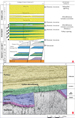

 Figure 2-2. Seismic line 1. South of the Obe
half-graben, the basement fabric dips parallel to the extensional
west-dipping master fault, coincidental with the major extension.
Figure 2-2. Seismic line 1. South of the Obe
half-graben, the basement fabric dips parallel to the extensional
west-dipping master fault, coincidental with the major extension.

