Click on green area to open detailed map (Figure 2).
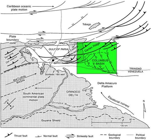
Figure 1. Tectonic map (after Pocknall et al., 1999) showing regional structural features of northern South America, including the island of Trinidad, as well as the modern outlet of the Orinoco River and location of the present-day delta relative to the Columbus Basin. Soldado 189 well is indicated in the Gulf of Paria.