![]() Click to view illustrations in PDF format.
Click to view illustrations in PDF format.
TRENTON – BLACK RIVER FORMATIONS OF MICHIGAN BASIN
Masera Corporation
(James Lee Wilson,* Joyce M. Budai,** and Arigeep Sengupta,*** principal investigators)
Search and Discovery Article #10020 (2001)
Summarized and adapted for online presentation from report, entitled “Trenton-Black River Study of the Michigan Basin, Masera Corporation, Tulsa, Oklahoma (www.masera.com). Appreciation is expressed to the Geological Society of America (GSA) for their permission to present Figures 1, 2, 4, 5, and 16 in slightly revised forms from the corresponding figures in GSA's The Geology of North America, v. D-2, North American Craton: U.S., L.L. Sloss, ed. 1988. They are reprinted by permission of GSA whose permission is required for further use).
*Consultant, New Braunfels, TX ( [email protected] )
**University of Michigan, Ann Arbor, MI ([email protected])
***Parkland, FL ([email protected])
|
tTrenton-Utica Contact / Hardgrounds tUtica and Younger Cincinnatian tAlbion-Scipio Field / Associated Fields tLucas-Monroe Trend / Associated Fields tConsumers Power Company No. 219 tOntario Geol. Surey Chatham No. 82-2 uAppendix B: Maps & Cross Sections
tTrenton-Utica Contact / Hardgrounds tUtica and Younger Cincinnatian tAlbion-Scipio Field / Associated Fields tLucas-Monroe Trend / Associated Fields tConsumers Power Company No. 219 tOntario Geol. Surey Chatham No. 82-2 uAppendix B: Maps & Cross Sections
tTrenton-Utica Contact / Hardgrounds tUtica and Younger Cincinnatian tAlbion-Scipio Field / Associated Fields tLucas-Monroe Trend / Associated Fields tConsumers Power Company No. 219 tOntario Geol. Surey Chatham No. 82-2 uAppendix B: Maps & Cross Sections
tTrenton-Utica Contact / Hardgrounds tUtica and Younger Cincinnatian tAlbion-Scipio Field / Associated Fields tLucas-Monroe Trend / Associated Fields tConsumers Power Company No. 219 tOntario Geol. Surey Chatham No. 82-2 uAppendix B: Maps & Cross Sections
tTrenton-Utica Contact / Hardgrounds tUtica and Younger Cincinnatian tAlbion-Scipio Field / Associated Fields tLucas-Monroe Trend / Associated Fields tConsumers Power Company No. 219 tOntario Geol. Surey Chatham No. 82-2 uAppendix B: Maps & Cross Sections
tTrenton-Utica Contact / Hardgrounds tUtica and Younger Cincinnatian tAlbion-Scipio Field / Associated Fields tLucas-Monroe Trend / Associated Fields tConsumers Power Company No. 219 tOntario Geol. Surey Chatham No. 82-2 uAppendix B: Maps & Cross Sections
tTrenton-Utica Contact / Hardgrounds tUtica and Younger Cincinnatian tAlbion-Scipio Field / Associated Fields tLucas-Monroe Trend / Associated Fields tConsumers Power Company No. 219 tOntario Geol. Surey Chatham No. 82-2 uAppendix B: Maps & Cross Sections
tTrenton-Utica Contact / Hardgrounds tUtica and Younger Cincinnatian tAlbion-Scipio Field / Associated Fields tLucas-Monroe Trend / Associated Fields tConsumers Power Company No. 219 tOntario Geol. Surey Chatham No. 82-2 uAppendix B: Maps & Cross Sections
tTrenton-Utica Contact / Hardgrounds tUtica and Younger Cincinnatian tAlbion-Scipio Field / Associated Fields tLucas-Monroe Trend / Associated Fields tConsumers Power Company No. 219 tOntario Geol. Surey Chatham No. 82-2 uAppendix B: Maps & Cross Sections
tTrenton-Utica Contact / Hardgrounds tUtica and Younger Cincinnatian tAlbion-Scipio Field / Associated Fields tLucas-Monroe Trend / Associated Fields tConsumers Power Company No. 219 tOntario Geol. Surey Chatham No. 82-2 uAppendix B: Maps & Cross Sections
tTrenton-Utica Contact / Hardgrounds tUtica and Younger Cincinnatian tAlbion-Scipio Field / Associated Fields tLucas-Monroe Trend / Associated Fields tConsumers Power Company No. 219 tOntario Geol. Surey Chatham No. 82-2 uAppendix B: Maps & Cross Sections
tTrenton-Utica Contact / Hardgrounds tUtica and Younger Cincinnatian tAlbion-Scipio Field / Associated Fields tLucas-Monroe Trend / Associated Fields tConsumers Power Company No. 219 tOntario Geol. Surey Chatham No. 82-2 uAppendix B: Maps & Cross Sections
tTrenton-Utica Contact / Hardgrounds tUtica and Younger Cincinnatian tAlbion-Scipio Field / Associated Fields tLucas-Monroe Trend / Associated Fields tConsumers Power Company No. 219 tOntario Geol. Surey Chatham No. 82-2 uAppendix B: Maps & Cross Sections
tTrenton-Utica Contact / Hardgrounds tUtica and Younger Cincinnatian tAlbion-Scipio Field / Associated Fields tLucas-Monroe Trend / Associated Fields tConsumers Power Company No. 219 tOntario Geol. Surey Chatham No. 82-2 uAppendix B: Maps & Cross Sections
tTrenton-Utica Contact / Hardgrounds tUtica and Younger Cincinnatian tAlbion-Scipio Field / Associated Fields tLucas-Monroe Trend / Associated Fields tConsumers Power Company No. 219 tOntario Geol. Surey Chatham No. 82-2 uAppendix B: Maps & Cross Sections
tTrenton-Utica Contact / Hardgrounds tUtica and Younger Cincinnatian tAlbion-Scipio Field / Associated Fields tLucas-Monroe Trend / Associated Fields tConsumers Power Company No. 219 tOntario Geol. Surey Chatham No. 82-2 uAppendix B: Maps & Cross Sections
tTrenton-Utica Contact / Hardgrounds tUtica and Younger Cincinnatian tAlbion-Scipio Field / Associated Fields tLucas-Monroe Trend / Associated Fields tConsumers Power Company No. 219 tOntario Geol. Surey Chatham No. 82-2 uAppendix B: Maps & Cross Sections
tTrenton-Utica Contact / Hardgrounds tUtica and Younger Cincinnatian tAlbion-Scipio Field / Associated Fields tLucas-Monroe Trend / Associated Fields tConsumers Power Company No. 219 tOntario Geol. Surey Chatham No. 82-2 uAppendix B: Maps & Cross Sections
tTrenton-Utica Contact / Hardgrounds tUtica and Younger Cincinnatian tAlbion-Scipio Field / Associated Fields tLucas-Monroe Trend / Associated Fields tConsumers Power Company No. 219 tOntario Geol. Surey Chatham No. 82-2 uAppendix B: Maps & Cross Sections
tTrenton-Utica Contact / Hardgrounds tUtica and Younger Cincinnatian tAlbion-Scipio Field / Associated Fields tLucas-Monroe Trend / Associated Fields tConsumers Power Company No. 219 tOntario Geol. Surey Chatham No. 82-2 uAppendix B: Maps & Cross Sections
tTrenton-Utica Contact / Hardgrounds tUtica and Younger Cincinnatian tAlbion-Scipio Field / Associated Fields tLucas-Monroe Trend / Associated Fields tConsumers Power Company No. 219 tOntario Geol. Surey Chatham No. 82-2 uAppendix B: Maps & Cross Sections
tTrenton-Utica Contact / Hardgrounds tUtica and Younger Cincinnatian tAlbion-Scipio Field / Associated Fields tLucas-Monroe Trend / Associated Fields tConsumers Power Company No. 219 tOntario Geol. Surey Chatham No. 82-2 uAppendix B: Maps & Cross Sections
tTrenton-Utica Contact / Hardgrounds tUtica and Younger Cincinnatian tAlbion-Scipio Field / Associated Fields tLucas-Monroe Trend / Associated Fields tConsumers Power Company No. 219 tOntario Geol. Surey Chatham No. 82-2 uAppendix B: Maps & Cross Sections
tTrenton-Utica Contact / Hardgrounds tUtica and Younger Cincinnatian tAlbion-Scipio Field / Associated Fields tLucas-Monroe Trend / Associated Fields tConsumers Power Company No. 219 tOntario Geol. Surey Chatham No. 82-2 uAppendix B: Maps & Cross Sections
tTrenton-Utica Contact / Hardgrounds tUtica and Younger Cincinnatian tAlbion-Scipio Field / Associated Fields tLucas-Monroe Trend / Associated Fields tConsumers Power Company No. 219 |
This article combines stratigraphic and structural analysis with carbonate petrographic and geochemical studies of the Middle Ordovician section hopefully for the benefit of those involved in Michigan Basin exploration. The Michigan Basin has been considered the type intracratonic basin of North America because it has a characteristic ovate form, a long history of relatively uniform subsidence during the Paleozoic and an extensive section of carbonate and evaporite rocks, as well as a substantial amount of shale and some sandstone. A time-depth (burial-history) curve extrapolated from known thicknesses shows a gradual subsidence of 10-20m per million years (Bubnoff units--B) except during Late Silurian and Early Devonian, when subsidence was more than 100 B. The basin has produced commercial hydrocarbons since the 1920's and has a mature exploration history. From 1950 to 1990, it produced between 15 and 25 million barrels of oil annually. Five main plays which developed during that time of exploration are (1) drilling of northwest-trending Late Paleozoic anticlines which cross the center of the basin, with resultant shallow production chiefly from Devonian carbonates and Mississippian sandstones; (2) development of shallow production in several areas of Silurian reefs in southern Michigan; (3) after 1966, development of a long narrow belt of Silurian pinnacle reefs across the northern part of the Lower Peninsula (with reserves of about 130 million barrels of oil); (4) major discovery in 1957 of the Albion-Scipio trend which follows a fracture zone affecting, and related to, the dolomitized Trenton carbonates (also with reserves of about 130 million barrels); and (5) discovery in the 1980's of deep gas in anomalously thick Lower to Middle Ordovician strata in the basin center. Because the basin is covered with glacial drift, outcrops occur only around its perimeter, and even geophysical exploration has been inhibited by the Pleistocene cover. For this reason the techniques of classical subsurface geology were pursued in exploration (i.e., use of cable tool and rotary drill cuttings). Only since World War II have extensive cores, good petrophysical logs, and seismology been extensively utilized. Because of its long history of development as a minor and somewhat dormant oil-gas basin, it is apparent that modern exploration thinking and technology could be usefully applied to the Michigan Basin.
Click here to view sequence of figures 1, 2, 4, 5, 16, and 17.
Click here to view sequence of figures 1, 2, 4, 5, 16, and 17. Click here to view sequence of figures 3 and 12. Click here to view sequence of figures 1, 2, 4, 5, 16, and 17. Click here to view sequence of figures 1, 2, 4, 5, 16, and 17.
Click here to view sequence of figures 3 and 12.
Click here to view sequence of figures 1, 2, 4, 5, 16, and 17.
Click here to view sequence of figures 1, 2, 4, 5, 16, and 17.
ORDOVICIAN STRATIGRAPHY AND TECTONIC DEVELOPMENT OF THE MICHIGAN BASIN PRECAMBRIAN BASEMENT TECTONIC PROVINCES IN MICHIGAN A geologic synthesis by Fisher et al. (1987) for the G.S.A. Decade North American Geology publication is invaluable in relating Late Precambrian basement tectonics to Ordovician and later sedimentation in the Michigan Basin. It integrates tectonic studies of W. Cambray (1979) and geophysical studies by Hinze et al. (1975). Figure 1 is a map prepared by Fisher et al. (1987) of interpreted Precambrian provinces based on gravity (Fig. 2), magnetics, and well data. The Grenville Metamorphic Front is a particularly important feature for Cambro-Ordovician depositional patterns (Figs. 1, 3, 4, and 5). The Cambrian depocenters lie west of the front, and the dominant central Michigan depression lies off this front to the northwest. The Bowling Green-Monroe mid-Paleozoic fault lies along the trace of the Grenville Front. A Trenton carbonate platform (St. Clair platform of Fisher and Barratt, 1985) developed over the Grenville Belt, probably in response to the rise of the Algonquin-Findlay arches which first developed over the Grenville Belt during Early and Middle Paleozoic. A province of 1.5 billion-year granite exists west of the north-south Grenville Front. Another important feature of the Precambrian basement is the Keweenawan Rift Zone, whose thick red beds and dense rift-type basaltic intrusives and flows are reflected by a pronounced Bouguer positive anomaly (Fig. 2). This megagraben trends north-south in the basin, lying west of the Paleozoic central low and curving southeastward where it is intersected (overthrust?) by the Grenville Front. The major mid-Paleozoic normal or transcurrent faults of Howell-Northville and Lucas-Monroe and many minor northwest-trending fractures lie within the graben and parallel its strike. The Albion-Scipio and Stony Point trends lie just southwest of the rift zone, but they also parallel it (Fig. 1; Map B-1). Where these fault trends are interpreted as normal, the northeast blocks are upthrown. (Fisher et al., 1988). Thus, the basement high of the Grenville Orogenic Belt on the east side of the Michigan Basin serves as a flank area to the central circular depression. The latter formed by a combination of subsidence west of the Grenville Front and the earlier Keweenawan rifting. There is no known basement change under the northwest and west quadrants of the basin; therefore, the regular subsidence on these sides may have been predominantly isostatic. Structure in the southern portion of the Michigan Basin is determined by the trends of two arches which evolved in Early to Middle Paleozoic and which branch off the major north-south Cincinnati-Nashville uplifts (Fig. 3). These are the composite Findlay-Algonquin and Kankakee-Wisconsin or Francesville arches; they were active throughout Early Paleozoic time. Lower Paleozoic strata up through the Trenton Formation thin over these structures and a post-Trenton karstic surface is thought to exist over the crest of these arches in Ohio and Indiana (Rooney, 1966). The final uplift of these arches, as suggested by surface geologic maps, was Late Paleozoic. REGIONAL TECTONICS AND STRATIGRAPHY OF THE CAMBRIAN-ORDOVICIAN The synthesis of the Cambro-Ordovician stratigraphy, regional setting, and structure is based on key deep tests in central Michigan and a variety of excellent studies (e.g., Fisher et al., 1988; Lilienthal, 1978; Bricker et al., 1983; and Catacosinos, 1973). Dresbachian (Sauk II Sequence) (Fisher et al., 1988) The lower Upper Cambrian units in the Michigan Basin are correlated on purely lithologic grounds with the thin sandy units of the Wisconsin outcrops and are presumably all Dresbachian (Upper Cambrian) sandstones and shales (Fig.4). The Mt. Simon is a relatively coarse sandstone that is arkosic at the base and shaly near the top. The overlying Eau Claire Formation consists predominantly of shales and sandstones which are commonly glauconitic. A white sandstone, the regressive Galesville, as the upper unit of this triplet, grades eastward into sandy dolomite. Dresbachian strata were deposited in two areas, the well-established central Michigan low and a subsidiary area in northeastern Illinois (Fig.4) (Fisher et al., 1988). The latter was stabilized after that time and did not continue to subside. Because the southwest edge of the Dresbachian (Sauk II) Sequence in the central Michigan Basin parallels the southwest side of the mid-Michigan positive gravity anomaly, the rift zone probably controlled this area of the depocenter. The Cambrian section thins to zero over the Algonquin Arch, where in Essex County, Ontario, Ordovician rests on Precambrian basement. Cambro-Ordovician (Sauk III) Franconian to top of Lower Ordovician The Michigan Basin strata are representative of the typical Cambro-Ordovician sequence of North America--essentially marine glauconitic sandstone-dolomite becoming progressively less sandy in the higher strata of the Lower Ordovician. They show the characteristic isopach pattern of the basin (Fig. 5). It is now important to know quite accurately the geographic distribution of the Upper Cambrian-Lower Ordovician and lowermost Middle Ordovician, for "deep" production in the basin was established by the natural gas discovered in the Dart-JEM Bruggers well of Missaukee County, from sandstone at 10,741 feet. The base of the sequence is a regional disconformity marking the beginning of the Franconian trilobite faunas of North America. There is upward conformable gradation into the great Lower Ordovician carbonate sheet. The sequence is capped by a regional unconformity developed on the central axis of the North American craton and over most uplifts (top of the Sauk Sequence of Sloss). In a few places (e.g., Appalachian, Anadarko and the center of the Michigan Basin) more or less continuous sedimentation occurred. Fisher and Barratt (1985) maintain that in the center of the Michigan Basin a 1500-ft unit of dark shaly dolomite (their Foster Formation or Prairie du Chien; Fig. 6) is Lower Ordovician in the lower part and Middle Ordovician at the top, based on conodonts (Repetski and Harris, 1981). It is overlain in the Brazos State Foster well by 972 ft of clean sandstone, which is much like the normal St. Peter in southwest Michigan (Bruggers Formation of Fisher and Barratt, 1985). The Prairie du Chien Formation in the center of the Michigan Basin is a composite of these two units. Cores representing these were examined in several wells. The units may be correlated on petrophysical logs between basinal wells using the work of Bricker et al. (1982), although those writers place the section in the Cambrian. From core examination, strata in the Brazos State Foster well (Ogemaw County) (Fig. 6) that underlie the St. Peter or Bruggers Sandstone are typical of the Cambro-Ordovician. They consist of dolomitic carbonates with all the features of tidal-flat sedimentation, including coarse flat-pebble conglomerate, edgewise conglomerate, finer grained, rounded-pebble conglomerate, spectacular algal stromatolites, and silty micrite laminites. These generally dark to medium gray strata are representative of tidal-flat environments so common in the Cambro-Ordovician. The only fossils are gastropods and a few oboloid brachiopods and trilobites. The Foster well bottomed in this presumed Lower Ordovician section at total depth (12,978.5 ft). It is apparent that subsidence of the depocenter of the Michigan Basin during Early Ordovician was matched by the rate of deposition of intertidal sediments; only a small amount of subtidal sediments was deposited. The major downwarp in which the Prairie du Chien is preserved may have formed after deposition of the carbonates. Lower Middle Ordovician Sandstones, Tippecanoe I Sequence (Fisher et al., 1988) A white sandstone which occurs between 9501 and 10,280 ft in JEM Freudenberg 1-31, Osceola County, is correlative with the "Bruggers" Sandstone of the Foster well (10,510 to 11,480 ft) and consists of medium to coarse, white to glassy sandstone, with intercalated low-angle crosslamination and Scolithos (vertical) burrowed zones. It is possible that the lowermost Middle Ordovician sandstone (Bruggers or St. Peter) has filled in a north-south graben in the center of the Michigan Basin, a rejuvenated structure inherited from the Keweenawan Rift. In southwest Michigan, Indiana, and northeast Illinois the well recognized St. Peter varies greatly in thickness from well to well (20-470 ft), indicating a fill-in of karst topography developed in the Kankakee Arch area (Fisher et al., 1988). Sandstone in both the St. Peter and Bruggers is similar--white to clear, quartzose sand with less than 2% pyrite and feldspar, some chlorite, and glauconite. Rounded, frosted quartz grains are common. It is typical of the widespread St. Peter sheet of central North America. Both the St. Peter and the Bruggers of Fisher and Barratt (1985) are overlain by the thin Glenwood Shale, a more or less uniform shale-dolomite-sandstone unit which marks the lower part of the Middle Ordovician sequence over the whole basin. The Glenwood is a green, sandy shale with interbeds of sandstone and limestone. It thickens from 10 ft to 50 ft in the center of the basin and includes some dolomite (Bricker et al., 1983). There is a problem distinguishing thickened sandy beds in the Glenwood from St. Peter in the basin center. If the Glenwood correlation is correct, the underlying Bruggers would be older Middle Ordovician. Without necessary fossils in the sands, this correlation problem may never be resolved to everyone's satisfaction. Bricker et al. (1983) recognize a "zone of unconformity" below the base of the typical Glenwood, reaching more than 140 ft in the basin center. A better term for this interval is probably lower Glenwood, as used by Fisher and Barratt (1985). The overlying section is another great sheet of Middle Ordovician carbonate, the Black River and Trenton formations. These strata host the largest single oil field in the state (Albion-Scipio). The lower part of the Middle Ordovician carbonate, the Black River Formation, consists of very micritic dense lime mudstone to wackestone with some brachiopods and possesses nodules of brown chert. Dark shale laminae in the Black River may indicate that source beds for petroleum occur within this carbonate sheet, in fact as high as the top of the Trenton Formation. The Black River contains two thin porosity zones in southernmost central Michigan. It is unknown whether these zones represent traceable stratigraphic units or a combination of local diagenetic effects, such as fracturing and dolomitization (Fig. 7) (Lilienthal, 1978). Gamma-ray and neutron-porosity-density logs show that the Black River, like the Trenton, is thinner and more argillaceous in the northeast quadrant of the basin. (Figs.7 and 8; Cross-sections B-B', C-C'). Otherwise it is a remarkably uniform unit, thickening gradually in the southeast quadrant from 150 to 500 ft. In practice the Black River is separated from the overlying Trenton by a pair of widespread gamma-ray markers which are generally presumed to be K-metabentonites. These are traceable across Ontario (R. Trevail, personal communication) and are quite probably the doublet of metabentonites noted by Cisne et al. (1982) in the lower Trenton Group just above its disconformable contact with the Lowville (Middle Ordovician) in the Mohawk River Valley near Little Falls, New York (M-20 bentonites). The gamma-ray deflections in the Trenton-Black River of Michigan undoubtedly represent the distal portion of the numerous bentonites (ash falls) derived from a volcanic center in the Taconic Orogenic Belt in the latitude of North Carolina. The bentonites are known in Middle Ordovician strata of Virginia, Pennsylvania, and New York. Kay and Colbert (1965) logged five such beds in the Nealmont and Black River Limestone and 8 to 10 in the overlying Salona unit of the Trenton in Central Pennsylvanian. Cisne et al. (1982) noted about 15 higher K-metabentonites in the Trenton and used them in New York State to erect a chronostratigraphic framework. These K-metabentonites, which may be also traced across Kentucky and into Iowa, form the best possible framework for age correlation. The work of Templeton and Wilman (1963) and Wilman and Kolata (1978) can be used to relate several bentonites exposed in outcrops of Delta County, Michigan, to the Michigan Basin subsurface and to the minutely subdivided Trenton-Galena and Black River-Plattville sections of Wisconsin and Illinois. Delta County has the only outcrops of the Middle Ordovician close to the northwestern perimeter; these are closest to the subsurface well log sections of the Lower Peninsula. The outcrop section is a composite of 205 ft, pieced together mostly by projecting fragmentary measured sections from river bluffs and small quarries along the Escanaba River into regional dip. The only correlatable units are the two bentonites recognized by Templeton and Wilman (1963). The lower (their Forreston equivalent) is assumed to be at the Trenton-Black River boundary, and the higher bentonite (Sherwood-Rivoli equivalent to three bentonites), about 85 ft below the top of Trenton, correlates on stratigraphic interval with the subsurface gamma-ray marker TG-1 of Lilienthal (1978) (Figs.7 and 8; Cross-sections B-B', C-C'). CORRELATION AND DEPOSITIONAL FACIES BACKGROUND The Trenton is treated herein in more detail than lower units because it is the chief Ordovician carbonate reservoir. An impressive amount of study has been made of Trenton-Black River carbonates in and around the Michigan Basin. Because four approaches have been made, based on different criteria, correlation of many published Middle Ordovician subdivisions is difficult or impossible. Before 1961, outcrop study in Delta County, in the Upper Peninsula of Michigan, Ontario, and Illinois placed most attention on identification of lithic units and megafossils, such as bryozoans, brachiopods, trilobites, and rugose corals. Lithic units were defined on the basis of faunal content, shaliness, dolomitization, and bedding character. Scores of thin, local to regional subdivisions were defined originally with biostratigraphic significance. Few, if any, of these can be applied to the Michigan Basin stratigraphy of the Trenton-Black River. This welter of outcrop names has inhibited any regional synthesis of the Middle Ordovician in the whole area. For example, it is not known whether the thin outcropping Trenton-Black River around the basin represents the whole section thinned by convergence or contains important disconformities which might correlate to porosity zones within the basin section. Cohee (1948) and Sanford (1961) chiefly used well cuttings to describe subsurface strata of Middle Ordovician carbonates without much attention to textural variations in the limestone-dolomite or to faunal content. Such descriptions note limestone as dense, fine-grained, fragmental, and note the color as gray, brown, dark, etc.; they are insufficient for environmental/facies determination but are of some use in estimating porosity in old wells. More recently gamma-ray and neutron-porosity-density logs have been used (Figs. 6, 7, 8, and 10) to correlate the Trenton-Black River across the basin (e.g., Fisher et al., 1969; Lilienthal, 1978; Wilson and Sengupta, 1985; and Fisher et al., 1988). Core examination of key wells has permitted more modern environmental description of the rocks using Dunham textures, sedimentary structures, and general faunal content. The integration of core description and resistivity logs is probably the most useful approach to Trenton subdivision in the basin. This study is designed to assist the explorationist in using this approach. A last method of internal Trenton-Black River correlation is conodont zonation, with calibration to gamma-ray deflections which are assumed to represent chronostratigraphic markers by corresponding to ash falls. This should provide a very accurate correlation framework. Conodonts were collected by Hogarth (Hogarth and Sibley, 1985) from a basinwide suite of cores to study the degree of organic maturation in the Trenton. This collection has been the subject of a taxonomic study by Robert Votaw of Northwest Indiana University at Gary. The following petrologic observations are of "normal" Trenton-Black River strata located away from the collapsed, fractured, and dolomitized areas like the Albion-Scipio and Northville fields in Michigan and Essex-Kent counties in Ontario. This summary is based on a variety of cores selected to cover platform to basin depositional facies (see Fig. A-1). Most cores are in Trenton platform facies. Hunt Winterfield Deep A-1 includes the upper 87 ft of the 257-ft Trenton in the area of the basin center in Clare County. Core descriptions are included here in a subsequent section. There is not much difference between the Trenton and Black River of the Michigan subsurface; both units are chiefly normal marine wackestone with a biota of echinoderms, bryozoans, brachiopods, trilobites, ostracods, conodonts, and a few rugose corals. Figure 10 illustrates typical Trenton textures. The Black River, which is cherty, contains more brown lime peloidal mudstone and less packstone. Figure 11 illustrates typical Black River textures. Slabbed cores provide information about sedimentary structures which assist greatly in environmental interpretations. Thin-shell brachiopods occur in coquinas of shell hash and pelmatozoans, and more rarely brachiopods may occur in cross-laminated packstone to grainstone textures representing bioclastic shoals. In some cores bryozoan colonies are common in the lower Trenton and upper Black River. These may be pencil-like stems of Trepostomes or the characteristic half moon-shaped Praesopora colonies. All fragments are 1/2 to 1 cm in diameter. Where coquinas of oriented brachiopods and bryozoan stems have been fractured and dolomitized, much leaching and subsequent partial infill by coarse dolomite rhombs have occurred. Both shelter and vuggy porosity are present in these rocks. Nodular limestone is common, due to (1) ball and flow structure resulting from differential compaction of shale seams and (2) minor carbonate masses and/or (3) original burrowed structure. Hardgrounds, lithoclasts, compacted shale seams, laminated shale beds, cross -laminated bioclastic units, minor graded storm layers a few centimeters thick, and thin-shell brachiopod coquinas constitute most of the other rock types seen in Michigan Basin cores. These rock types alternate seemingly without any consistent order. The Trenton of the northern part of Lower Peninsula of Michigan is different from that of the basin flanks and shelf. The color changes from brown and light brown in the south to dark gray in the north. Laminated dark and light gray units a few centimeters thick appear, and both Trenton and Black River are more shaly. The upper 40 ft of these strata have 3.5 to 4.8% total organic carbon (TOC) as contrasted with TOC of .3 to .4% in southern Michigan for the same interval (Taylor, 1982). The facies change is gradual and some rocks similar to those on the shelf occur in the basin area. The formations thin in the northern basin, an area which was the depocenter of earlier Paleozoic units. From sporadic exposures in the outcrop area of Delta County of the Upper Peninsula, a composite section of the Trenton is 200 ft thick. Although the various sections are shaly, like those in the northern "deep" area of the basin, they are lighter colored, more dolomitic, and contain more brachiopods and bryozoans. Thus, they indicate a more shelfward facies rather than a basinward facies. The farthest northwest exposures in the outlying downfaulted block at Limestone Mountain, central Houghton County, comprise the Trenton (Galena) Dolomite, 200 ft thick. The Decorah (Lower Galena argillaceous beds) apparently is absent in Delta County, on the basis of both lithology and fauna (Votaw, 1980, 1985). To the south of the Michigan Basin on the Indiana Shelf, the Trenton is about 150-200 ft thick and possesses a cap of ferroan dolomite, 5-20 ft thick, which is principally dolomitized wackestone; this cap overlies a major bioclastic sand facies which is tens of feet thick and which is underlain by a bryozoan micritic mound facies. A basal thin bioclastic unit rests on Black River wackestone-mudstone (Keith, 1985). In Ontario major subdivisions within the Trenton are recognized on outcrop. The upper (Cobourg) member is a nodular or ball-and-flow wackestone unit, and the middle (Verulam) is a bioclastic packstone and grainstone. The lower (Kirkfield) is pellet wackestone with burrow mottling. These subdivisions become less clear in the subsurface of Ontario and across the wide carbonate bank onto the Michigan Shelf. In general one may recognize in Michigan an upper skeletal facies and a lower, less bioclastic and more micritic facies with somewhat more argillaceous seams and ball-and-flow texture. However, the change is very gradual, and it does not seem feasible for this study to make member subdivisions of the Trenton in the Michigan subsurface. The Trenton-Black River in Michigan, as well as the Galena to the west, contain no tidal-flat sedimentary structures and no clear indications of downslope bryozoan micritic mounds. Both of these contrasting facies are known farther east in the Appalachians. The Middle Ordovician carbonate sheet in the northern Middle West represents a widespread open marine shelf except for the euxinic sediments in the depocenter of the northern part of the Michigan Basin. One might assume water depths of tens to 300 ft. Calcareous algae are rare to absent. The absence of tidal flats in such a widespread carbonate sheet argues for some depth of water to permit open marine circulation over such a wide area. Delgado (1983) makes the same interpretation of an open marine shelf low in the photic zone for the Galena in Wisconsin, Illinois, Iowa, and Minnesota. TECTONIC IMPLICATION OF TRENTON THICKNESS AND FACIES The isopach of Trenton (Map B-2) and isopach of Black River (Map B-3) are used to interpret depositional history because the unit is defined at its base by excellent gamma-ray markers which represent K-metabentonites (ash falls) and are thus chronostratigraphic markers. These separate Trenton from the Black River whose base is gradational to the Glenwood and somewhat more difficult to delineate. The sandstone fill-in ("Bruggers" of Fisher and Barratt, 1985) above the Sauk Sequence distorts any attempt to estimate subsidence using the combined Middle Ordovician strata. Likewise the great influx of Late Ordovician shale obscures clues of gross depositional history from an isopach of the complete Tippecanoe I Sequence (Fisher et al., 1988). The top of the Trenton has long been used as a stratigraphic datum. Detailed log correlations (Lilienthal, 1978) within the Trenton show little or no truncation at the top of the formation, and the ingress of Utica Shale from the east must have very rapidly buried a flat carbonate surface which is considered chronostratigraphic for all intents and purposes. The circular form of the Michigan Basin, set from Upper Cambrian to Middle Ordovician, contrasts markedly with the north-south linear trends of the Precambrian. Some of the major northwest-southeast and north-south faults were active in Trenton time. Anomalous variations in thickness occur along the Bowling Green to Lucas-Monroe and Northville trends. The thickest area of the Trenton (400-500 ft) lies in southeast Michigan and extends northeastward into Ontario. Within this area gamma-ray markers within the Trenton can be easily correlated. In Lapeer and Tuscola counties, which are within this thick area, the Trenton consists of brown, non-argillaceous bioclastic limestone with brachiopods and crinoids based on well cuttings from three wells (Sun Richardson-1, Lapeer County; Baybur Wacho-1, Tuscola County, 10N-9E; and Gulf Bateson, Bay County). Studies in southeast Michigan and western Ontario show that 400-500 ft of open marine Trenton formed on a carbonate platform that prograded out from the Algonquin-Findlay arches northwest toward the central Michigan depocenter (Maps B-1, B-2, B-3). The platform more or less overlies the Grenville Front of the Precambrian basement (Map B-1). The northern area of thin, dark, somewhat argillaceous Trenton coincides with the thick subsident area of Cambrian-Ordovician deposition. Apparently carbonate sedimentation kept pace with subsidence on the southeast quadrant of the basin (St. Clair platform of Fisher) but was unable to do so in the north and northwest subsident areas. The Trenton thins rapidly northwest of the Thumb Saginaw Bay area to less than 250 ft. Here gamma-ray correlations are not so easy to make with those of the thick area. Logs in this area show more argillaceous and darker, laminated limestone strata; typical Trenton is represented by the section in Hunt Winterfield Deep A-1 in Clare County. The northern area of the Lower Peninsula of Michigan probably represents deeper water and somewhat more euxinic sedimentation. Conodont zonation within the Trenton would be helpful to confirm the presence of a carbonate bank and partly starved sedimentation in the basin center. The south-central and southwest parts of the basin show gradual thinning to 250 ft onto the Indiana platform (Kankakee Arch) where the section contains more dolomite. Similar thinning and dolomitization occurs over the Findlay Arch. Further study, including conodont zonation, is needed before it can be determined whether this thinning is caused by convergence at the sides of the basin or elimination of stratigraphic units over the arches. The uppermost part of the northern, somewhat basinal Trenton contains a thin organic-rich shale whose type area is south of Georgian Bay at Collingwood, Ontario. This shale crops out in limited exposure on the Garden-Stonington Peninsula across Bay du Noc from Escanaba and has been the subject of detailed study by Churcher (1985) and Russell and Telford (1983) in Ontario because it is a possible petroleum source bed and oil shale (average TOC ranges from 2% to 5-10%). The high organic content results in a high resistivity which can be used to define the Collingwood on logs when paired with a higher gamma ray deflection than that of the typical Trenton limestone below. Hiatt and Nordeng (1985) studied the Collingwood in several wells in Michigan. Its distribution is patchy in the Lower Peninsula; e.g., absent in State Blair 2-24 (Grand Traverse County), present in Wagner-2 (Delta County, Upper Peninsula) and present again in Allis 2-30 and Shell Taratuta 1-13 (Presque Isle County), State Albert 1-10 (Montmorency County), and Shell Sheldon State-Wellington 1-35 (Alpena County). In all these wells the Collingwood is about 10 to 20 ft thick. Hiatt and Nordeng note that the Collingwood has a hardground at its top with phosphate pellets. The same relationships have been described by Churcher in Ontario, both above and below the Collingwood; here similar surfaces of nondeposition are marked by ferruginous phosphatic pebbles, dolomite, and late ferroan calcite. These are much more prominent at the top of the Collingwood, indicating that it is an integral part of the Trenton. Churcher further suggests that the hardground surfaces are developed on the upthrown sides of fault blocks which result from the reticulate pattern of faulting proposed by Sanford (1985) from Silurian edgeline and isopach studies. Map B-4 shows the southern limit of the Collingwood. Its zero line is placed farther north than shown by Hiatt and Nordeng (1985). Maximum thickness is about 40 ft. The Collingwood is distributed in a broad belt close to its outcrop, stretching across from northwest of Lake Michigan to the Georgian Bay area in Ontario and southeast across Ontario to Toronto. From there it extends across Lake Ontario and Lake Erie into Ohio, where the facies is known as the Cynthiana or Pleasant Point Shale (Keith, 1985). The Cynthiana contains the same brown organic-rich shale in the subsurface of Ohio. A similar shale (Scales Formation) in Illinois is present in the basal part of the Maquoketa (Kolata and Grease, 1983); it apparently is younger and of Cincinnatian age (based on conodonts). The cause of restricted circulation to form these organic-rich shales is not clear. Perhaps the shallowing caused by the Trenton bank and Algonquin Arch over southern Michigan is the significant factor, although sediments across the bank are fully marine and certainly the top of the bank shows no evidence of shoaling to subaerial exposure. Neither the underlying limestone (of the Trenton) nor overlying Utica-Blue Mountain Shale is so rich in organic carbon. Thus the Collingwood, along with some thin shales in the lower Trenton and Black River, is a potential petroleum source rock. Its equivalent in southeastern Ohio, the Cynthiana-Pleasant Point Shale, is thought to be the source for the major oil and gas accumulations along the Findlay Arch (L. Wickstrom, personal communication). TRENTON-UTICA CONTACT AND HARDGROUND SURFACES The top of the Trenton is a widely recognized and traceable stratigraphic boundary throughout the basin, well marked on both petrophysical and lithologic logs and also visible seismically. It is commonly used as a datum for structure contour maps and is assumed to be a chronostratigraphic surface. Some arguments prevail about whether the sharp upper contact of the Trenton and Utica is widely unconformable. Arguments advanced in favor of such a view include: 1. Very abrupt change from limestone upward to shale over the entire southern basin. 2. Presence of a lamellar crustose micritized limestone with upward extrusions resembling caliche (?) in some cored contacts. 3. Alleged unusual thickening of Utica Shale along the strike of the Albion-Scipio trend (Ells, 1962), indicating possible post-Trenton solution collapse along the fracture before or during Utica deposition and inferring ingress and solution by meteoric water at that time. 4. Development of a pattern of irregular Trenton thickness seemingly related to fracturing and solution collapse along the crest of the Findlay Arch, where as much as 60 ft of relief is documented, along with drill-bit drops at the contact. 5. Delineation of a cap of dolomite 5 to 50 ft thick present along the south and west sides of the Michigan Basin. It is fine- to medium-grained, gray, and ferroan (7 mean mole percent) and moderately light isotopically (d18O PDB is -7.7) compared to regional dolomite in the Galena and in the Trenton of southwest Michigan Basin, suggesting some meteoric input during dolomitization. Keith (1985) has expressed a contrary opinion about the sharp Utica-Trenton contact; namely, that whereas it may represent a stillstand in sedimentation, no subaerial unconformity developed at that time. Coogan and Maxey (1980) likewise cast doubt on a regional disconformity at the top of the Trenton as proposed by Rooney (1966). The Trenton becomes shaly in the Michigan Basin depocenter, and certainly little evidence exists here for a major unconformity; the contact with the Utica is almost gradational except for a pyritic, phosphatic hardground at the top of the Collingwood. Keith's (1985) arguments against the regional disconformity in Indiana and southern Michigan are: 1. The sharp top of Trenton surface seen in cores of the Michigan Basin wells is better interpreted as a marine hardground. Hardground surfaces are also known within the outcropping Trenton in neighboring areas (Wilkinson and Janecke, 1982; Templeton and Wilman, 1963, p. 184-185). The former authors note that they are marked by micritized limestone fabric, borings, and blocky calcite cement which is so closely associated with marine fossils and borings as to be interpreted as marine despite its blocky crystal form (Wilkinson and Janecke, 1982). Phosphatic and dark ferrous-manganous staining is present, and much pyrite may be concentrated along the surface. Wavy stromatolitic structure may also be present as encrustation on the limestone as well as lithoclastic conglomerate. These layers are present throughout the Trenton, although a clearly defined layer is commonly present at its top or at the top of the Collingwood. 2. Fara and Keith (1985), investigating about 17 or 18 cores from the Indiana Shelf, have also noted abundant phosphate and pyrite, carbonate lithoclasts, and surface borings at the upper Trenton contact, but they express the opinion that the surface appears to be of nondeposition and not erosion. 3. The very irregular, karst-like topography over the Findlay Arch may be related to faulting (Keith, 1985) but is so complex that present consensus agrees with earlier ideas that it represents solution collapse as well as fracturing and dolomitization at an unconformity. The question remains as to whether such a disconformity exists over all of northern Indiana as proposed by Rooney (1966). The importance of an unconformity at the top of the Trenton is great because it would have widely influenced dolomitization and fracture history of the top of the Trenton. A correct interpretation of these processes is necessary to explore successfully for more hydrocarbons within the Trenton and Black River formations. THICKNESS AND CORRELATION OF UTICA AND YOUNGER CINCINNATIAN STRATA Upper Ordovician strata record a considerable influx of argillaceous mud from the rising Taconic Orogenic Belt in the northern Appalachians. The Cincinnatian shales have been subdivided into five units by Nurmi (1972) and Lilienthal (1978), who correlated these units across the basin. The Utica Shale is more radioactive and less calcareous than the higher Upper Ordovician shales. The uniformity of the stratigraphic units argues against any drastic erosion at the top of the Cincinnatian although some erosion of the upper unit exists in southern areas of the basin. The five Cincinnatian units become more calcareous and contain fossiliferous limestone on outcrop in the Garden Peninsula. This makes the Silurian-Ordovician contact difficult to pick even though some Upper Ordovician strata were eroded. Upper Ordovician strata thicken into the Michigan Basin from the north, south, and west sides from 500 to more than 800 ft and thicken continuously eastward toward the source area of the Queenston delta. Some upper Cincinnatian strata are red even in the basin. They reach 1000-1500 ft across Ontario toward New York State. It is impossible to use the Upper Ordovician shale units to ascertain basin subsidence in the same way as the well-defined and uniform Trenton and Black River carbonates. West of the basin the shales grade into cherty and dolomitic carbonate units (Maquoketa Group), except for the highest shales (Richmondian) which persist across the western United States to become the uppermost Maquoketa of Iowa and the Stoney Mountain of Manitoba and Williston Basin. The lower part of the Upper Ordovician becomes the Red River of the western areas. DOLOMITIZATION AND LATE DIAGENESIS IN THE TRENTON-BLACK RIVER FORMATIONS The Trenton Formation and the upper part of the Black River have been extensively dolomitized on the southwestern flank of the basin (Fig. 12). The Trenton has been partially dolomitized on the western and eastern margins of the basin and in the basin center (Wilson and Sengupta, 1985). Outcrops of Trenton in Delta County and well cuttings of Trenton from the northern Michigan Basin are only slightly dolomitic. In general, the Trenton is more dolomitic than the Black River. In the oil fields with fractured reservoirs the Trenton and upper Black River are completely dolomitized, and the lower Black River is partly to completely dolomitized. Some diagenetic features, along with examples of porosity types, are illustrated in Figures 13 and 14. Taylor and Sibley (1986) recognize three types of dolomite in the Trenton Formation. Type 1 is referred to as a regional dolomite which dominates the south and west quadrants of the basin. It is fine- to medium-grained, pervasive, and sucrosic. The regional dolomitization may have been inhibited in the central and eastern parts of the basin by lack of proximity to regional recharge areas or by the argillaceous and organic content of the eastward-derived clastics. Timing of this dolomitization could have been penecontemporaneous, but it could just as well have been post-Trenton. Based on our core studies, it may have occurred at the same time as the ferroan cap dolomite, but prior to fracture-related dolomite. The "cap" dolomite, which is calcian and ferroan, is most abundant around the southern and western margins of the basin. Taylor and Sibley (1986) suggest that the distribution is controlled by subaerial exposures and the availability of reduced sulfur. Where reduced sulfur was present, iron was tied up in sulfide minerals and where sulfur was oxidized, as on the southern shelf, precipitation of iron-rich dolomite occurred. The Utica Shale is a possible source for iron present in Trenton dolomite. This second dolomite has been referred to as the "cap dolomite" because it is confined to the upper 50 ft (15 m) of the Trenton Formation. It may serve as an impermeable seal over the more porous Trenton below. However, we find that ferroan dolomite is common to abundant throughout the Trenton and Black River Formations in the Albion-Scipio and Northville fields. In locations away from the southern oil fields, as in Sun Bradley No. 4 or Mobil Jelinek-Ferris No. 1, dolomite constitutes only 20-30% of the section, but it is predominantly ferroan. Generally there are two stages of ferroan dolomite, the first being less ferroan than the last stage. In many cases there is a second, nonferroan dolomite cement which formed between the two ferroan stages. Taylor (1982) reports a basin-center dolomite, which is also ferroan. We conclude that the "cap dolomite" is in fact related to the main regional dolomitization episode, but it has been affected by local variations in fluid chemistry. We agree that the Utica is the most important source of iron for the cap dolomite. The third type of dolomite reported by Taylor and Sibley (1986) occurs as coarse fracture-lining baroque cement and as sucrosic replacive dolomite within the highly fractured zones associated with most Trenton oil fields in the basin. Our core study indicates that it ranges from nonferroan to highly ferroan and may have.formed during an early stage of hydrocarbon migration (as discussed below). It is nearly everywhere compositionally zoned, based on examination of stained thin-sections. Petrographic examination, using UV fluorescence on thin-sections from the Albion-Scipio and Northville fields, indicates that liquid hydrocarbon inclusions have been trapped in the late-stage baroque dolomite cements. The UV wavelength excites liquid hydrocarbon inclusions, causing them to fluoresce brightly compared to surrounding host cements. In these areas, liquid hydrocarbons occur as primary and secondary inclusions in fracture-lining dolomite and as secondary inclusions in nonferroan and ferroan regional dolomites. Bitumen commonly coats the outer crystal surfaces of vug- and fracture-lining dolomite cement. The paragenetic sequence worked out by Ardrey (1978) for Albion-Scipio and Keith (1985) for northern Ohio indicates that collapse brecciation, host-rock replacement by nonferroan and ferroan dolomite, and porosity generation are all closely associated in time and space and were followed by coarse, saddle-shaped (baroque) dolomite vein-filling, sulfide mineralization, and oil migration. In most cores examined, the final dolomite cement is followed by calcite and/or anhydrite cement. The calcite is nonferroan and also contains hydrocarbon fluid inclusions. In the Albion-Scipio and Northville areas, there is also minor late-stage Mississippi-valley-type (MVT) mineralization. In some of the Northville cores pyrite, barite, and calcite fill fractures. In the Humble Riley core from Albion-Scipio, trace amounts of fluorite occur as a final fracture filling. Sphalerite intergrown with calcite fills minor fractures in Total Faist 2-12 (Fig.13[4]). This late-stage mineralization is generally restricted to the Black River or lower Trenton Formation. The Late Paleozoic is considered a time of major sulfide mineralization in zones ringing the intracratonic basins of North America. Associated with these MVT deposits is late-stage precipitation of baroque dolomite and calcite cements as "gangue minerals" that commonly host liquid hydrocarbon inclusions. This kind of mineralization has also been reported in the Trenton from Ohio (Haefner and Mancuso, 1986). The coarse dolomite cements, vuggy porosity, and late-stage sulfide and sulfate mineralization characteristic of Trenton-hosted oil fields in the Michigan Basin are strikingly similar to MVT carbonate host rocks. There are three constraints on any model(s) used to explain Trenton-Black River dolomitization. First, there is a tremendous volume of dolomite in the Trenton. Second, it is concentrated on the south and west sides of the basin. Third, much of it is slightly to highly ferroan in composition. In order to dolomitize a thick, widespread sequence of limestone, an enormous amount of dolomitizing fluid is required. By far the most geologically reasonable and chemically feasible water is a marine or marine-derived brine (Land, 1986). The regional dolomite almost certainly formed as a result of mixed marine-meteoric diagenesis sometime after Trenton deposition. The regional distribution of this dolomite suggests that the Kankakee and Findlay arches served as upland recharge areas for meteoric water migration into the Ordovician section. The stable isotopic composition of regional dolomite in the Trenton reported by Taylor and Sibley (1986) is consistent with mixed marine-meteoric dolomitization during Middle to Late Ordovician (Fig. 15). Because the ferroan content is generally low in the regional dolomite (Taylor and Sibley, 1986), an unusual source for the iron is not required. Presumably the shaly layers within the Trenton-Black River combined with the overlying Utica Shale were an adequate source for the iron. Interestingly, the cap dolomite has almost the same isotopic composition as the regional dolomite (Fig. 15). It is slightly depleted with respect to both oxygen and carbon, a feature due to differences in minor-element compositions and organic content between the two types. It may also record interaction with more depleted brines during later burial diagenesis. Fracture dolomite is common only within the major fracture systems in the southeastern part of the basin. A minor amount of baroque dolomite occurs in dry holes or in non-producing areas. It is clearly limited by the location of fractured zones and is invariably a late-stage cement. These dolomites have a broad range of depleted isotopic compositions; they probably formed at higher temperatures much later in the burial history of the Trenton-Black River. The occurrence of liquid hydrocarbon inclusions within some baroque dolomite cements suggests that at least one stage of hydrocarbon migration was synchronous with this stage of fracture mineralization. The occurrence of ferroan dolomite during several stages of Trenton-Black River diagenesis suggests multiple iron sources. Although it is difficult to demonstrate, it appears that the later stage baroque ferroan cements formed from fluids ascending through the fracture systems. Based on preliminary examination of several cores, there is a significant amount of ferroan dolomite, both as a replacive phase and a fracture-filling cement, in the Prairie du Chien Formation. Perhaps fluids circulating deeply through Precambrian and Cambrian units have contributed iron and other trace metals to a former hydrothermal system. The late-stage mineralization in the Trenton-Black River is restricted to the lower part of the section, also suggesting a fluid source from below the Black River. FRACTURE PATTERNS IN THE TRENTON-BLACK RIVER AND ASSOCIATED PRODUCING ZONES Depositional facies within the Middle Ordovician carbonate sheet in the Michigan Basin do not seem to relate directly to reservoir development. However, facies may well control indirectly the fracture pattern along which collapse brecciation, dolomitization, and vein filling have occurred to produce and modify the selective Trenton porosity. Major fractures are confined to southern Michigan and to trends which were forming as early as Middle Ordovician time. These dolomitized fractures occur within the proposed thick Trenton carbonate bank northwest of the Findlay-Algonquin Arch, as well as on its crest in Ohio and Indiana. The fractures occur in the Ordovician above where the Precambrian rift zone impinges against the Grenville Front (Map B-1). Fractures were possibly localized on the platform by the early cemented and more resistant carbonate bank sediments, which include a large amount of echinodermal debris. This same bank facies was subjected to both regional and ferroan dolomitization, although it is not certain whether dolomitization resulted from down-flowing metoric water off the Kankakee-Wisconsin-Findlay Arch or from burial waters expressed from the Utica and older shales farther out in the basin. If fracturing controls dolomitization, collapse, and porosity, any established trends and spacing pattern of such would be a predictive tool. Because seismic and gravity techniques do not clearly outline some of the fractures, any knowledge of their framework and patterns established from field lineation and geologic history becomes important. The major trends of both Trenton fields and structure across southern Michigan may be related to Middle Ordovician and later isopach anomalies except for the largest accumulation along Albion-Scipio. The general pattern is oriented N45oW, but the northern and middle portions of Albion-Scipio have a N30-35oW trend. The Lucas-Monroe Fault (Bowling Green extension) is oriented north-south. ALBION-SCIPIO FIELD AND ASSOCIATED FIELDS The largest single field in Michigan is the Albion-Scipio in Hillsdale, Jackson and Calhoun counties. This is a sharply defined belt in the Trenton of collapse breccia and dolomite about 3/4 mi wide and more than 35 mi long. Its trend is composite, with narrow en echelon bands a few hundred yards apart and trending about N30-35oW. In addition there is a second order of shorter fractures projecting east from southern Albion-Scipio into the Moscow township. A central depression follows the middle of the belt as a series of irregular sinks with an average relief of 50 ft and a maximum of 100 ft. Ells (1962) and Shaw (1975) demonstrate that the depression is expressed on thickness maps of Silurian and Devonian strata. The producing zones immediately underlie the central depression and thus are related to its formation. Vertical displacement by faulting is minimal to absent, and the system of fractures has been conjectured to result from transcurrent movement in the basement or very minor upthrow to the northeast. A very subtle Bouguer gravity anomaly, expressed as flattening of contours, apparently follows the field. Both the field and this subtle gravity anomaly lie west of and parallel to the major Bouguer gravity positive anomaly indicative of the Precambrian Keweenawan Rift Zone. There appears to be no thinning of Trenton-Black River over the field (Shaw, 1975; Ells, 1962) although Rooney (1966) is of the opinion that thinning occurs. The trend of the field parallels the thickness contours of the Trenton. Regionally the Trenton surface dips basinward (northeastward) at about 170 ft/mi. The tilt on the top Trenton surface along Albion-Scipio is much less at 33 ft/mi. The northern end of the field is about 1300 ft structurally lower than the southern extremity. It has been postulated that Trenton porosity zones spreading both east-west and northwest-southeast cut across structural dip; on cross sections, they are shown to be parallel to some higher datum and not to the inclined Trenton surface. Hence, porosity (cavernous and vuggy) would have been developed after regional basin subsidence. Because the subsidence rate was at a maximum during Late Silurian-Early Devonian, the cavernous porosity zones probably did not form earlier than Late Devonian, and they may be of Late Paleozoic age. The tiny Reading Field, lying 15 mi southwest of Albion-Scipio (T7S-R4W), consists of about a dozen wells on a structure whose residual relief after regional trend is removed is only 20-30 ft. Well locations show a barely discernible northwest trend. Hanover and Stoney Point trends are much more impressive and have about 16 and 60 wells, respectively. They lie about 5 mi northeast of the main Albion-Scipio trend. Ells (1962) and Lizotte (1961) outline the important characteristics of these fracture fields in southern Michigan, with a major structural trend of N45oW. Second-order fractures extend northward into southern Oakland County from the southern part of Northville. According to Ells (1962) production of oil and gas at Northville is from a narrow, fractured and dolomitized zone in the Trenton-Black River. In detail, at the Trenton level Ells shows several narrow (less than a mile wide), en echelon anticlines trending northwest-southwest and extending through parts of Wayne, Washtenaw, and Oakland counties. These anticlines are asymmetrical; the northeast is the steeper flank, along which local structural relief on the Trenton surface is more than 380 ft in wells less than 1/2 mile apart (Amoruso, 1957). Gas production is from wells relatively high on structure. Trenton-Black River cores examined by Ells (1962) from wells on the steeper flank are fractured, brecciated, and dolomitized. The southwest flank seemingly is unproductive of hydrocarbons and water because limestone rather than dolomite is present in wells that outline this part of the structure. On the other hand, a Trenton structural map of Northville by Lizotte (1961) shows steeper dip to be on the southwest side of the structure. A similar map by Amoruso (1957) shows a more or less symmetrical, northwest-plunging anticline with only about 100 ft of closure and no faulting. An isopach map of Lower Silurian and Cincinnatian strata shows thinning coincident with Trenton structure, implying movement at least as early as Late Ordovician. According to Ells (1962), the Northville anticline is apparently one of several narrow, en echelon, anticlinal noses which together constitute the Howell anticlinal system. Subsurface data, according to Ells, indicate that the southwest flank of the Howell structure is faulted with vertical displacement as much as 1000 ft. Production has been obtained from Ordovician rocks in Livingston and Shiawassee counties portion of the Howell anticlinal system, where only a few Trenton-Black River tests have been drilled. Steep dip is persistently on the southwest flank, as reflected by Ordovician, Silurian, Devonian, and Mississippian units. In fact, the overall structure of the Howell and Northville is depicted by the subcrop pattern below the glacial drift. LUCAS-MONROE TREND AND ASSOCIATED FIELDS Erratic production is present along the north-south axis of the Lucas-Monroe fault system. Half of the Deerfield field production is related to the northwest trends described by Ells (1962). It is related to a part of the Bowling Green fault system which follows the western edge of the north-trending Lucas Monocline, a large regional flexure extending from Lucas County, Ohio, northward into Michigan. Detailed Trenton maps indicate a series of small, low-relief, en echelon anticlines plunging to the northwest. Deerfield occupies a small part of the steeply dipping west flank of the Lucas structure. Production, associated with fractured dolomitized Trenton, is limited mainly to a narrow zone along the flexure edge. Mississippian and some Upper Devonian formations terminate sharply against the west flank of the Lucas Monocline. The Michigan part of it is related to other anomalous Trenton structural features to the north. The north-south Lucas-Monroe structural trend in Washtenaw County is intersected by a N45oW trend, along which the tiny Freedom field lies. It is southwest of the Northville and Howell anticlines. This group of two small, narrow anticlines is not as well defined as the Howell anticline system. On the southwest flank dip is more than 275 ft/mi. Dip on the northeast flank is about one-fifth of that. Structural relief of nearly 600 ft is expressed by Devonian formations. One well produced oil with salt water from a dolomitized zone within a predominantly limestone section on the southwest flank of the Freedom structure. It was abandoned in 1956. Data suggest that the fault-related anticlinal structure experienced subsequent dolomitization, especially on the southwest flank. Study of the Wyandot and Harlem trends in Wyandot and Senaca counties, Ohio, shows that the northwest-trending fracture pattern extends onto the southeast flank of the Findlay Arch. The same type of breccia and late, coarse baroque dolomite, associated with Pb-Zn mineralization, is a feature of these fields (L. Wickstrom, personal communication). The trends noted here suggest two dominant fracture patterns, oriented northwest-southeast and north-south, and a second-order east-west trend, which is also apparent in southwest Ontario. A general consensus exists that the fault and fracture pattern may be best explained by wrench movement of basement blocks. This process, with several phases, was accentuated toward the end of the Paleozoic. The fracture pattern of Paleozoic and Precambrian sediments in Ontario in terms of large continent-wide lineaments suggests that a change occurs in the Paleozoic fracture pattern along the southern flank of the Algonquin Arch where Cambrian sandstone and dolomite lap-out against the Precambrian basement (Sanford, 1985). Maps show a curving east-west to northeast pattern over a Niagara megablock southeast of the Algonquin Arch and a simpler, well developed east-west pattern in the Bruce megablock northwest of the Algonquin Arch. Sanford relates various oil and gas traps in Ontario to permeability pinchouts at the intersections of fractures and faults (Northwest Maldens, Leamington and Dover) or the concomitant growth of Silurian bioherms on the more positive areas. Extension of this proposed fracture system into the south and east flanks of the Michigan Basin is possible, with a northwest- and northeast-trending, reticulate system over the Findlay Arch and development there of karstic, solution-collapse, and dolomitized reservoirs. A structure contour map on the upper Middle Devonian Traverse Limestone (Fig. 16) reflects a summation of Middle and Late Paleozoic deformation across the basin. Northwest trends have been interpreted as the result of wrench faulting associated with the Pennsylvania Appalachian orogeny. This pattern overprinted the major Middle Paleozoic fault and fracture patterns in southern Michigan and extended far to the north to affect the entire basin. It is possible that solution, collapse, brecciation, and dolomitization within the Trenton along lineaments continued to latest Paleozoic. SIGNIFICANCE OF THE TRENTON-BLACK RIVER (ALBION-SCIPIO TYPE) RESERVOIR GENERAL STATEMENT Reservoirs in the Trenton-Black River somehow require the combination of dolomite and fractures, but the details of this relationship are still quite unclear. Trenton-Black River oil and gas fields occur in areas with only a partially dolomitized section. Pervasive dolomitization does not seem to be conducive to the development of reservoirs. Furthermore, although fractures trending NW-SE, as in Albion-Scipio, are considered critical in the development of the reservoirs, these fractures occur in other parts of the basin with variable percentages of dolomite without development of reservoirs. Trenton-Black River oil and gas fields are also related to the Findlay-Algonquin axis. It is obvious that there are different types of dolomites and fractures and that a successful exploration-production strategy requires consideration of the types, timing and role of dolomites and fractures, nature of the Trenton-Utica contact, and origin of caves in the Trenton. The amount of dolomite in the Trenton-Black River has no relation to the potential of reservoir development. The only consistent trend is the presence of late baroque dolomite related to fractures and vugs in practically all the productive horizons. However, this late dolomite is also present in other parts of the basin without significant development of reservoir properties. The origin of the earlier "regional" and "cap" dolomite is very relevant to the understanding of the Trenton-Utica contact, the possibility of meteoric karst, and formation of caves. This report favors a mixing marine-meteoric origin for the earlier dolomites, thereby requiring the subaerial exposure of the Trenton with potential recharge in the Findlay and Kankakee arches (Fig. 17). The main implication of a mixing meteoric-marine model is the need for subaerial exposure and recharge of the basin margins (at least in the west, south, and southeast). This should have been a pre-Utica event, and it would have required that the Trenton-Black River act as a relatively good aquifer. In regard to timing, if dolomitization occurred after deposition of the Utica Shale, the mixing marine-meteoric mechanism would require a well developed confined (artesian) karst flow with an extensive recharge area and a discharge area that paleotopographically was much lower. The regional setting does not favor the development of this type of karst system. If the subaerial exposure occurred before deposition of the Utica Shale, it would be difficult to explain variable amounts of ferroan "cap" dolomites and the differences in fabrics within the regional dolomite. The regional dolomite may have occurred penecontemporaneously with Trenton-Black River deposition as a consequence of shallowing upward cycles, for which, however, there are no indication. Alternatively, compaction of the laterally equivalent basinal shales could provide an adequate mechanism for some of these early dolomitization events. Post-Utica dolomitization by compaction of basinal shales could account for some of the variations in dolomite fabrics and chemistry. In any case, these dolomites would tend to be more stratabound than the late dolomites which are related to fractures. This contact is considered an unconformity, with characteristic lithologies of a submarine hardground and condensed sequence. (The term unconformity is used here in a general sense of measurable stratigraphic gap). However, this does not negate the possibility of previous subaerial exposure. In fact, the distribution of the "cap" dolomite and the Collingwood Shale, together with the presence of clastic carbonates in the Collingwood Shale, is suggestive of exposure at the top of the Trenton. Because of the geometric relationships of the Trenton and Collingwood, this possible subaerial exposure would have been minor, and any subaerial exposure profile developed would be very thin (few feet) and easily masked or eroded as a result of the submarine exposure. The presence of cavernous porosity in the Trenton-Black River is not diagnostic of subaerial exposure and meteoric karst, as caverns are very well developed in hydrothermal karst. The depressions and irregularities at the top of the Trenton, with thinning of the Trenton and thickening of the Utica, need not to be associated with meteoric karst and subaerial exposure. These features could have originated later as a result of hydrothermal karst. Caverns occur at different depths in the entire Trenton-Black River section (approximately 500 ft) in the Albion-Scipio area. Individual caves are reported to be up to 80 ft high or more. Although some authors believe in a major subaerial exposure at the end of Trenton deposition with development of several cave levels as in modern meteoric karst, we believe that this is very unlikely. There is no evidence of major drops of base (sea) level at the end of the Trenton to account for these deep caverns. There is no evidence of pre-Utica paleotopographic lows of the order of 500 ft. Pay zones cut across the Albion-Scipio structure (Bishop, 1967), suggesting post-deformation development of porosity. The presence of baroque dolomite and some MVT ore deposits in these pay zones are suggestive of fracture-controlled hydrothermal karst. There is also some evidence of upward movement of this hydrothermal karst water. Caves tend to be larger at depth, or at least better reservoir properties occur at depth or in downthrown fault blocks. Mineralization is also more intense at depth. Waters in a hydrothermal karst could be derived from deep circulation of meteoric waters, with contributions from connate waters. Hydrothermal karsts are known to form large cave systems, with or without mixing with meteoric karst waters. Changes in C02 pressure, temperature variations, and mixing corrosion are the main controls of hydrothermal cave formation. According to Bishop (1967), the Albion-Scipio structure originated in Late Silurian-Early Devonian by reactivation of a Late Precambrian lineament. This tectonic event generated a hydrothermal karst along NW-SE fracture trends that feather out to the north. and northwest, with a later (Mid-Late Devonian?) partial collapse of cavern porosity. The Albion-Scipio is actually portrayed as a depression on the Trenton platform. It is likely that not all the Precambrian lineaments will produce similar fracture patterns in the Trenton-Black River. Fracture density is greatly controlled by pre-existing lithology and bed thickness. Fractures will be better developed in the Trenton-Black River where beds are thicker, with less shale interbeds and insoluble residues and more grain-supported fabrics. Dolomite ("regional" and "cap") horizons in the Trenton-Black River will present denser fracture networks and more potential for karst development than the limestone horizons. This lithologic control on the fracture patterns could explain some of the details of the reservoir distribution in the basin. Nevertheless, the concentration of the oil and gas fields to the southeast of the basin suggests another control. This is the area of the active Cincinnati Arch. The possible recharge areas of the Findlay Arch (NE-SW) could feed the NW-SE fault trends directly with large amounts of waters. This unique situation might be the key control of the distribution of major reservoirs in the basin. TRENTON-BLACK RIVER PALEOKARST, A PLAY CONCEPT There is evidence of a hydrothermal karst system in the Trenton-Black River during Devonian, controlled by the location of re-activated NW-SE faults, in direct connection (perpendicular) to the recharge areas to the SE. There is no evidence of a pre-Utica paleokarst. Some of the exploration-production implications are as follows: 1. Reservoirs were generated from below rather than from above. Better reservoir properties can be expected in deeper, well fractured intervals. 2. Early dolomitization could control fracture density and late reservoir development. 3. Optimum reservoir development can be expected in areas that were tectonically active in Late Silurian-Early Devonian and were directly connected to meteoric recharge areas. 4. Similar paleokarst systems could be expected where basement fractures affect younger carbonates. Amoruso, J.J., 1957,A Structural study of the Northville oil field, Washtenaw, and Oakland counties: M.A. thesis, University of Michigan, Ann Arbor, 25 p. Ardrey, R.H., 1978, Diagenesis of the Middle Ordovician Trenton Formation in southern Michigan: M.A. thesis, University of Michigan, Ann Arbor. Bishop, W.C., 1967, Study of the Albion-Scipio Field of Michigan: M.S. thesis, Michigan State University, East Lansing. Bricker, D.M., Milstein, R.L., and Reszka, D.R., 1983, Selected studies of Cambro-Ordovician sediments within the Michigan Basin: Michigan Geological Survey, Report Investigation 26, 54 p. Cambray, F.W., 1979, The Precambrian basement of Michigan in the hydrocarbon potential of the Michigan Basin, the way ahead: Symposium Michigan Basin Geological Society, p. 5. Catacosinos, P.A., 1973, Cambrian lithostratigraphy of the Michigan basin: Amer. Assoc. Petrol. Geologists Bull. v. 57, p. 2404-2418. Churcher, P. L., 1985, Geology and Geochemistry of the Collingwood member, Lindsay Formation, southern Ontario: B.S. thesis, University of Waterloo, Ontario, 46 p. Cisne, J.L., Karig, D.E., Rabe, B.D., and Hay, B.J., 1982, Topography and tectonics of the Taconic outer trench slope as revealed through gradient analysis of fossil assemblages: Lethaia, v. 15, p. 229-246. Cohee, G.V., 1948, Cambrian and Ordovician rocks in Michigan Basin and adjoining areas: Amer. Assoc. Petrol. Geologists Bull., v. 32, p. 1417-1448. Coogan, A.H., and Maxey, M.M., 1980, Oil and gas occurrence in Trenton limestone reservoir. Unpublished report Ohio Geol. Survey, p. 185-209. DeHaas, R.J., AND Jones, M.W., 1989, Cave-levels of the Trenton-Black River Formations in central southern Michigan, in Keith, B.D., ed., The Trenton Group (Upper Ordovician Series) of Eastern North America: American Association of Petroleum Geologists, Studies in Geology 29, p. 237-266. Delgado, D.J., 1983, Ordovician Group of the Upper Mississippi Valley, deposition, diagenesis and paleoecology: Guidebook for 13th Annual Field Conference, SEPM, Great Lakes Section, p. A1-A17. Ells, G.D., 1962, Structures associated with the Albion-Scipio oil field trend: Michigan Geol. Survey Pub. 86 p. Fara, D.R., and Keith, B.D., 1984, Depositional facies and diagenetic history of Trenton limestone in northern Indiana (Abst): Amer. Assoc. Petrol. Geologists, Bull. v. 68, p. 1919. Fisher, J.H., Barbour R.F., Elles, G.D., Fugate, R.F., Helmboldt, D.E., Lundy, C.L., and Mantek, W.E., 1969, Stratigraphic cross sections of the Michigan Basin: Michigan Basin Geol. Soc. Publication. Fisher, J.H., Barratt, M.W., Droste, J.B., and Shaver, R.H., 1988, Michigan Basin, in Sedimentary Cover--North American Craton: U.S., L.L. Sloss, ed., The Geology of North America, v. D-2, Geol. Soc. America, p. 361-382. Fisher, J.H., and Barratt, M.W., 1985, Exploration in Ordovician of central Michigan Basin: Amer. Assoc. Petrol. Geologists Bull., v. 69, p. 2065-76. Green, D.A., 1957, Trenton structure in Ohio, Indiana and northern Illinois: Amer. Assoc. Petrol. Geologists, Bull. v. 41, p. 627-642. Haefner, R.J., and Mancuso, J.J., 1986, Mississippi Valley Type mineralization and dolomitization in the Trenton Formation, Wyandot County, Ohio (Abst): AAPG Bulletin, v. 71 or 72. Hiatt, C.R., and Nordeng, S., 1985, A Petrographic and well log analysis of five wells in the Trenton-Utica transition in the northern Michigan Basin: in K.R. Cercone and J.M. Budai (eds.), Ordovician and Silurian rocks of Michigan Basin, Michigan Basin Geol. Soc. Symp. Spec paper 4, p. 33-34. Hinze, W.J., Kellogg, R.L., and Merritt, D.W., 1971, Gravity and aeromagnetic anomaly maps of the southern peninsula of Michigan: Michigan Geology Survey Report Invest. 14, 15p. Hinze, W.J., Kellogg, R.L., and O'Hara, N.W., 1975, Geophysical studies of basement geology of southern peninsula of Michigan: Amer. Assoc. Petrol. Geologists Bull., v. 59, p. 1562-1584. Hogarth, C.G., and Sibley, D.F., 1985, Thermal history of the Michigan Basin: evidence from conodont coloration index: in K.R. Cercone and J.M. Budai (eds.) Ordovician and Silurian Rocks of the Michigan Basin: Michigan Basin Geol. Soc. Symp., Spec. Paper 4, p. 45-58. Kay, M., and Colbert, E.H., 1965, Stratigraphy and Life History: J. Wiley and Sons, New York, 148 p. Keith, B.D., 1985, Facies, diagenesis and the upper contact of the Trenton limestone of northern Indiana: in K.R. Cercone and J.M. Budai (eds.) Ordovician and Silurian Rocks of the Michigan Basin, Michigan Basin Geol. Soc. Symp., Spec. Paper 4, p. 15-32. Kolata, D.R., and Graese, A., 1983, Lithostratigraphy and depositional environments of the Maquoketa Group (Late Ordovician) of Northern Illinois: Illinois Geol. Survey, Circ. 527, 49p. Land, L.S., 1986, The origin of massive dolomite: J. Geologic Education, NAGT, v. 33, p. 112-125. Lilienthal, R.T., 1978, Stratigraphic cross sections of the Michigan Basin: Michigan Geol. Survey, Rept. Invest. 19, 36p., 89 pls. Lizotte, M., 1962, Structural and lithological controls on oil and gas producing zones in Trenton limestones: M.A. thesis, University of Michigan, Ann Arbor. Nurmi, R.D., 1972, Upper Ordovician stratigraphy of the southern peninsula of Michigan: M.S. thesis, Michigan State University, East Lansing. Prouty, C.E., 1984, Trenton exploration and wrenching tectonics (Abst): Eastern Section Amer. Assoc. Petrol. Geologists Meeting, Pittsburg, PA., p. 20. Repetski, J., and Harris, A., 1981, Report on referred fossils, Lower and Middle Ordovician, Ogemaw County, Michigan: U. S. Geol. Survey, Paleo. & Stratigraphy branch, written communication. Rooney, L.F., 1966, Evidence of unconformity at top of Trenton Limestone in Indiana and adjacent states: Amer. Assoc. Petrol. Geologists Bull., v. 50, p. 533-546. Russell, D.J. and Telford, P. G., 1983, Revisions to the stratigraphy of the Upper Ordovician Collingwood beds of Ontario - a potential oil shale: Canadian Jour. Earth Science, v. 20, p. 1780-1790. Sanford, B.V., 1961, Subsurface stratigraphy of Ordovician rocks in southwestern Ontario: Geologic Survey of Canada Paper 60-26, 54p. Sanford, B.V., Thompson, F. J., and McFall, G. H., 1985, Plate tectonics a possible controlling mechanism in the development of hydrocarbon traps in southwestern Ontario: Bull. Can. Petrol. Geology, v. 33, p. 52-71. Shaw, B., 1975, Geology of the Albion-Scipio trend, southern Michigan: M.A. thesis, University of Michigan, Ann Arbor, 64p., 5 pls. Taylor, T.R., 1982, Petrographic and geochemical characteristics of dolomite types and the origin of ferroan dolomite in the Trenton Formation of Michigan: Ph.D. dissertation, Michigan State University, East Lansing, 75p. Taylor, T.R., and Sibley, D.F., 1986, Ferroan dolomite in the Trenton Formation, Ordovician, Michigan Basin: Sedimentology, v. 33, p. 61-86. Templeton, J.S., and Wilman, H.B., 1963, Champlainian Series (Middle Ordovician) in Illinois: Illinois State Geol. Survey, Bull. 89, 260p. Votaw, R.B., 1980, Ordovician and Silurian stratigraphy in the Upper Peninsula of Michigan: Michigan Basin Geol. Soc. Field Conf., 40p. Votaw, R.B., 1985, Conodont biostratigraphic correlations around the Michigan Basin: in K.R. Cercone and J.M. Budai (eds.), Ordovician and Silurian rocks of the Michigan Basin, Michigan Basin Geol. Soc. Symp., Spec. Paper 4, p. 59-72. Wilkinson, B.H., and Janecke, S.V. 1982, Low Mg calcite marine cement in Middle Ordovician hardgrounds from Kirkfield, Ontario: Jour. Sed. Petrology, v. 52, p. 47-57. Wilman, H.B., and Kolata, D.R., 1978, The Platteville and Galena groups in northern Illinois: Illinois State Geol. Survey Cir. 502, 75p. Wilson, J.L., and Sengupta, A., 1985, The Trenton formation in the Michigan Basin and environs: pertinent questions about its stratigraphy and diagenesis: in K.R. Cercone and J.M. Budai (eds.) Ordovician and Silurian Rocks of the Michigan Basin, Michigan Basin Geol. Soc. Symp. Spec. Paper 4, p. 1-13. CORE DESCRIPTION, ANALYSIS, AND INTERPRETATION: EXAMPLES Lithologic descriptions and mineralogic identifications are based on petrographic study of stained slabs and thin sections. Alizarin Red S was used to distinguish calcite from dolomite, and potassium ferricyanide was used to identify ferroan carbonate cements. In slabs or thin sections, pale to dark blue indicates that the sample has been stained with potassium ferricyanide and is ferroan. Calcite appears deep red and nonferroan dolomite is white or gray. In special cases, as indicated in figure captions, mineralogic identifications were based on energy-dispersive scanning-electron microscopy (SEM) analysis. Locations of wells from which cores were described, analyzed, and interpreted are shown in Figure A-1. Examples presented here are from the following wells: Carter Lauber No. 12 Section 6-16N-17W Sun Bradley No. 4 Section 11-12N-13W Mobil Jelinek Ferris No. 1 Section 5-5N-2E Consumers Power Company No. 219 Section 17-1S-8E Sun Buss-Haab No. 1 Section 8-3S-4E Humble Riley No. 2 Section 26-3S-4W Anderson Whitaker No. 2 Section 29-7S-4W Ontario Geological Survey Chatham No. 82-2
WELL: Lauber No. 12 LOCATION: 6-16N-17W, Oceana County, Michigan CORED DEPTHS: 4947-4986 ft; 5081-5110 ft; 5153-5242 ft STRATIGRAPHIC UNITS: Trenton (4944-5120 ft), Black River (5120-5234 ft), Glenwood-St. Peter (5234-5250 ft) WIRELINE LOG (Fig. A-2) Analysis and Interpretation (Figs. A-3, A-4) The Trenton and Black River formations have been extensively dolomitized in this well, but with a few exceptions the porosity is less than 5% throughout the cored interval. Bedding is nodular to wavy; depositional texture is predominantly skeletal wackestone; and burrowing is common. Anhydrite nodules are common in the upper part of the core. Replacive dolomite and dolomite cements are moderately ferroan. The few fractures present are lined with dolomite cement and filled with either calcite or anhydrite. The upper contact with the Utica Shale (4947 ft) was not cored, but the lower contact with the Glenwood Formation (5230 ft) is present and appears gradational. It is marked by the first appearance of quartz sand interbedded with fine-grained, ferroan dolomite. WELL: Bradley No. 4 LOCATION: 11-12N-13W, Newaygo County, Michigan CORED DEPTHS: 5960-6464 ft STRATIGRAPHIC UNITS: Utica, Trenton-Black River (5976-6387 ft), Glenwood-Prairie du Chien (6387-6464 ft) WIRELINE LOG (Fig. A-5 [from comparable interval in well in 15-11N-13W]) Analysis and Interpretation (Figs. A-6, A-7) This core includes the Trenton-Utica contact (5976 ft) as well as the Trenton-Black River interval, through the Glenwood into the Prairie du Chien Formation. The Trenton-Black River is composed of slightly dolomitic, skeletal packstones, wackestones, and lime mudstones. The Black River also contains peloidal wackestones and packstones. Dolomite, which ranges from less than 5 to 300, is ferroan. Thin intervals (less than 1 ft) are completely dolomitized. Porosity is less than 5% in most of the core. Fractures and veins are rare. The lower Black River has common anhydrite nodules, and abundant pyrite. WELL: Jelinek-Ferris No. 1 LOCATION: 5-5N-2E, Shiawasee County, Michigan CORED DEPTHS: 6110-6191 ft STRATIGRAPHIC UNIT: Trenton (6110-6567) WIRELINE LOG (Fig. A-8) PETROLOGIC LOG: 5 Analysis and Interpretation (Figs. A-9, A-10) This core includes the upper 80 ft of the Trenton. This interval consists of burrowed lime wackestones. Sedimentary breccias similar to those described in Total Faist 2-12 are present in this interval. The Trenton at this location is less than 25% dolomite. Fractures are rare and filled with calcite followed by dolomite cement. Dolomite is ferroan and concentrated in burrows and burrow-mottled patches. Porosity is very low throughout the core. COMPANY: CONSUMERS POWER COMPANY WELL: No. 219 LOCATION: 17-1S-8E, Wayne County, Michigan CORED DEPTHS: 3881-4326 ft STRATIGRAPHIC UNITS: Trenton (3873-4285 ft), Black River (4285-4439 ft, TD) WIRELINE LOG (Fig. A-11) PETROLOGIC LOG: 12 Analysis and Interpretation (Figs. A-12, A-13) This core includes the complete Trenton section as well as the upper part of the Black River. The entire core has been completely dolomitized; fracture porosity ranges from 5 to 10% in much of the cored interval. The Trenton Formation consists of burrow-mottled wackestones in the upper 80 ft of the section followed by skeletal packstones with wackestones. The Black River consists of shaly, cherty skeletal wacke/packstones with minor packstones. Bryozoan buildups are common in the lower Trenton and upper Black River. Anhydrite nodules are intermittently common throughout the core. Open fractures are lined with coarse ferroan dolomite cement followed by anhydrite or calcite cement. The dolomite cements exhibit 2 to 3 stages of cementation: (1) moderately ferroan, (2) nonferroan, and (3) highly ferroan cement. The nonferroan cement is well-developed only in the uppermost and lower part of the core. Replacive dolomite is moderately ferroan throughout the core. WELL: Buss-Haab No. 1 LOCATION: 8-3S-4E, Washtenaw County, Michigan CORED DEPTHS: 3766-4542 ft STRATIGRAPHIC UNIT: Trenton (3761-4196 ft), Black River (4196-4542 ft) WIRELINE LOG (Fig. A-14) PETROLOGIC LOG: 17 Analysis and Interpretation (Figs. A-15, A-16) This well is located approximately halfway between the Albion-Scipio and Northville fields. The entire Trenton and Black River formations are included in the core. The Trenton Formation has a ferroan dolomite cap (approximately 8 ft) and thin dolomite intervals, but it is predominantly dolomitic limestone. Depositional texture varies from skeletal wackestone to packstone, with minor lime mudstones near the base of the Trenton. Skeletal packstones are more common in the Trenton in this well than in the Albion-Scipio area, and bryozoan mud mounds (or bioherms) are common in the lower half of the Trenton and the upper part of the Black River. Fractures are filled with ferroan dolomite or calcite followed by anhydrite. Silicification of skeletal material is common in the lower half of the Trenton; disseminated pyrite is locally common in the upper Trenton. The Black River is composed of cherty skeletal wacke/packstones and dolomite mud/wackestones. The lower 180 ft of the Black River is ferroan dolomite. Narrow fractures are filled with ferroan dolomite followed by anhydrite and rarely by calcite. Disseminated pyrite is locally common in the lower half of the Black River. WELL: Riley No. 2 LOCATION: 26-3S-4W, Calhoun County, Michigan CORED DEPTHS: 4071-4262 ft STRATIGRAPHIC UNIT: Trenton (3875-4202 ft), Black River (4202-4262 ft, TD) WIRELINE LOG (Fig. A-17) Analysis and Interpretation (Fig. A-18, A-19) This well is typical of Trenton-Black River in the Albion-Scipio Field. The Trenton consists of skeletal wackestones and packstones, with local development of crinoidal grainstones and bryozoan mud mounds. The Black River is predominantly skeletal wackestones with some packstone and cherty mudstones. The entire Trenton interval and most of the Black River have been completely dolomitized. The first generation of replacive dolomite is nonferroan; it was followed by extensive ferroan dolomitization. The latter type both replaces the remaining lime mudstone and fills fractures and vugs as cement. Porosity is excellent (15-20%) in highly fractured intervals, but it is substantially less in the mudstones of the Black River. Fractures in the Black River are lined with dolomite as they are in the Trenton, but the final fracture filling is variable and includes calcite, anhydrite, and rarely fluorite. WELL: Whitaker No. 2 LOCATION: 29-7S-4W, Hillsdale County, Michigan CORED DEPTHS: 3042-3265 ft STRATIGRAPHIC UNIT: Trenton (3030-3300 ft TD) WIRELINE LOG (Fig. A-20) Analysis and Interpretation (Figs. A-21, A-22) This well is located in the Reading Field in south-central Michigan. The Trenton in this core is quite similar to that in the Albion-Scipio and Northville fields with respect to lithology, major diagenetic stages, and porosity development. The Trenton consists of skeletal wackestones and packstones with shaly intervals common in the lower part of the core. The bottom is approximately 200 ft above the Black River, based on regional thickness of the Trenton. The upper 100 ft are predominantly dolomite, and the lower half of the core ranges from 25 to 1000 dolomite. Porosity varies from less than 5 to 10%. The most porous zones correspond to highly fractured, completely dolomitized intervals. Replacive dolomite generally has nonferroan cores and ferroan rims, but it may be ferroan throughout. Open fractures are generally lined with (1) nonferroan dolomite and (2) ferroan dolomite cements. Less commonly, fractures and vugs are lined with ferroan or nonferroan dolomite and filled with calcite, anhydrite, or celestite. COMPANY: ONTARIO GEOLOGICAL SURVEY WELL: Chatham No. 82-2 LOCATION: Harwich Township, Kent County, Ontario CORED DEPTHS: 898-1023 m (2945-3355 ft) STRATIGRAPHIC UNIT: Trenton Analysis and Interpretation The Trenton Formation here consists of interbedded/interlaminated skeletal packstones and wackestones. Burrow-mottling and nodular bedding are common throughout. The lower 140 m of the core are extremely shaly. Replacive dolomite is rare except for the top 3 which consist of very fine, dense dolomite cored interval. Porosity is less than 5% throughout the cored interval. MAPS AND CROSS SECTIONS
|
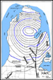 Fig.
1--Structural contour map on Precambrian basement (after Fisher et al.,
1988,
Fig.
1--Structural contour map on Precambrian basement (after Fisher et al.,
1988, 
 Fig.
3--Generalized structural setting for the Michigan Basin showing major
surrounding arches and outcrop pattern beneath Pleistocene glacial drift.
The present outcrop pattern is essentially that at the end of the
Paleozoic.
Fig.
3--Generalized structural setting for the Michigan Basin showing major
surrounding arches and outcrop pattern beneath Pleistocene glacial drift.
The present outcrop pattern is essentially that at the end of the
Paleozoic.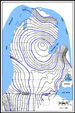

 Fig.
7--Gamma-ray log cross-section of south-central Michigan across Trenton
platform showing high gamma-ray deflections used to subdivide
Trenton-Black river carbonates (Lilienthal, 1978).
Fig.
7--Gamma-ray log cross-section of south-central Michigan across Trenton
platform showing high gamma-ray deflections used to subdivide
Trenton-Black river carbonates (Lilienthal, 1978). Fig.
9--Gamma-ray cross-section of Ordovician of Michigan basin, showing
organic-rich Collingwood Shale at top of Trenton and Trenton-Black River
contact based on doublet of gamma-ray deflections as well as facies change
from more argillaceous and micritic carbonate to more skeletal carbonate
in the Trenton.
Fig.
9--Gamma-ray cross-section of Ordovician of Michigan basin, showing
organic-rich Collingwood Shale at top of Trenton and Trenton-Black River
contact based on doublet of gamma-ray deflections as well as facies change
from more argillaceous and micritic carbonate to more skeletal carbonate
in the Trenton.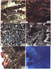 Fig. 10--Photomicrographs of Trenton textures.
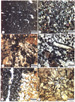 Fig. 11--Photomicrographs of Black River
textures.
Fig. 11--Photomicrographs of Black River
textures. Fig.
12--Percentage of dolomite in Trenton Formation modified from Wilson and
Sengupta, 1985, using additional core data.
Fig.
12--Percentage of dolomite in Trenton Formation modified from Wilson and
Sengupta, 1985, using additional core data.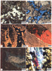 Fig. 13--Photomicrographs of Trenton porosity and
diagenesis.
Fig. 13--Photomicrographs of Trenton porosity and
diagenesis.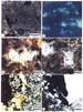 Fig. 14--Photomicrographs of Black River porosity and
diagenesis.
Fig. 14--Photomicrographs of Black River porosity and
diagenesis.
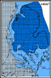 Fig.
17--Approximate position of regional and cap dolomite within the
Trenton-Black River formations showing potential direction of
recharge (modified illustration prepared by
Fig.
17--Approximate position of regional and cap dolomite within the
Trenton-Black River formations showing potential direction of
recharge (modified illustration prepared by  Figure A-1. Location map showing locations of
wells, cores from which were described, analyzed, and interpreted and
stratigraphic cross sections B-B' and C'C' (Appendix B).
Figure A-1. Location map showing locations of
wells, cores from which were described, analyzed, and interpreted and
stratigraphic cross sections B-B' and C'C' (Appendix B). Figure
A-2. Wireline log of Trenton and Black River formations, along with
underlying and overlying units, in Carter Lauber No. 12, Section
6-16N-17W.
Figure
A-2. Wireline log of Trenton and Black River formations, along with
underlying and overlying units, in Carter Lauber No. 12, Section
6-16N-17W. Figure A-3. Photographs of
core samples from Trenton and Black River formations in Carter Lauber No.
12, 6-16N-17W.
Figure A-3. Photographs of
core samples from Trenton and Black River formations in Carter Lauber No.
12, 6-16N-17W.  Figure A-4. Photomicrographs
of thin-sections of core samples from Trenton and Black River formations
in Carter Lauber No. 12, 6-16N-17W.
Figure A-4. Photomicrographs
of thin-sections of core samples from Trenton and Black River formations
in Carter Lauber No. 12, 6-16N-17W.  Figure
A-5. Wireline log of Trenton and Black River formations, along with
underlying and overlying units, in well in 15-11N-13W, with comparable
stratigraphic section to that in Sun Bradley No. 4, Section 11-12N-13W.
Figure
A-5. Wireline log of Trenton and Black River formations, along with
underlying and overlying units, in well in 15-11N-13W, with comparable
stratigraphic section to that in Sun Bradley No. 4, Section 11-12N-13W.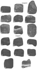 Figure A-6. Photographs of
core samples from Utica, Trenton, Black River, and Glenwood formations in
Sun Bradley No. 4, 11-12N-13W.
Figure A-6. Photographs of
core samples from Utica, Trenton, Black River, and Glenwood formations in
Sun Bradley No. 4, 11-12N-13W.  Figure A-7. Photomicrographs
of thin-sections of core samples from Trenton and Black River formations
in Carter Lauber No. 12, 6-16N-17W.
Figure A-7. Photomicrographs
of thin-sections of core samples from Trenton and Black River formations
in Carter Lauber No. 12, 6-16N-17W. 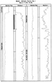 Figure
A-8. Wireline log of Trenton and Black River formations, along with
overlying unit, in Mobil Jelinek Ferris No. 1, Section 5-5N-2E.
Figure
A-8. Wireline log of Trenton and Black River formations, along with
overlying unit, in Mobil Jelinek Ferris No. 1, Section 5-5N-2E.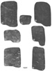 Figure A-9. Photographs of
core samples from Trenton Formation in Mobil Jelinek-Ferris No. 1,
5-5N-2E.
Figure A-9. Photographs of
core samples from Trenton Formation in Mobil Jelinek-Ferris No. 1,
5-5N-2E. 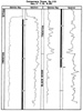 Figure
A-11. Wireline log of Trenton and Black River formations, along with
overlying units, in Consumers Power Company No. 219, Section 17-1S-8E.
Figure
A-11. Wireline log of Trenton and Black River formations, along with
overlying units, in Consumers Power Company No. 219, Section 17-1S-8E.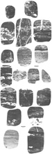 Figure A-12. Photographs of
core samples from Trenton and Black River formations in Consumer Power
Company No. 219, 17-1S-8E.
Figure A-12. Photographs of
core samples from Trenton and Black River formations in Consumer Power
Company No. 219, 17-1S-8E. Figure A-13. Photomicrographs
of thin-sections from core samples from Trenton Formation in Consumer
Power Company No. 219, 17-1S-8E.
Figure A-13. Photomicrographs
of thin-sections from core samples from Trenton Formation in Consumer
Power Company No. 219, 17-1S-8E.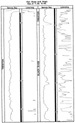 Figure
A-14. Wireline log of Trenton and Black River formations in Sun Buss-Haab
No. 1, Section 8-3S-4E.
Figure
A-14. Wireline log of Trenton and Black River formations in Sun Buss-Haab
No. 1, Section 8-3S-4E.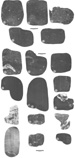 Figure A-15. Photographs of
core samples from Trenton and Black River formations in Sun Buss-Haab No.
1, 8-3S-4E.
Figure A-15. Photographs of
core samples from Trenton and Black River formations in Sun Buss-Haab No.
1, 8-3S-4E. Figure A-16. Photomicrographs
of thin-sections from core samples from Trenton and Black River formations
in Sun Buss-Haab No. 1, 8-3S-4E.
Figure A-16. Photomicrographs
of thin-sections from core samples from Trenton and Black River formations
in Sun Buss-Haab No. 1, 8-3S-4E. Figure
A-17. Wireline log of Trenton and Black River formations, along with
overlying unit, in Humble Riley No. 2, Section 26-3S-4W.
Figure
A-17. Wireline log of Trenton and Black River formations, along with
overlying unit, in Humble Riley No. 2, Section 26-3S-4W.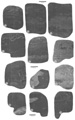 Figure A-18. Photographs of
core samples from Trenton and Black River formations in Humble Riley No.
2, 26-3S-4W.
Figure A-18. Photographs of
core samples from Trenton and Black River formations in Humble Riley No.
2, 26-3S-4W. Figure A-19. Photomicrographs
of thin sections and SEM photomicrograph from core samples from Trenton
and Black River formations in Humble Riley No. 2, 26-3S-4W.
Figure A-19. Photomicrographs
of thin sections and SEM photomicrograph from core samples from Trenton
and Black River formations in Humble Riley No. 2, 26-3S-4W. Figure
A-20. Wireline log of Trenton Formation, along with overlying unit, in
Anderson Whitaker No. 2, Section 29-7S-4W.
Figure
A-20. Wireline log of Trenton Formation, along with overlying unit, in
Anderson Whitaker No. 2, Section 29-7S-4W. Figure A-21. Photographs of
core samples from Trenton Formation in Humble Anderson Whitaker No. 2,
29-7S-4W.
Figure A-21. Photographs of
core samples from Trenton Formation in Humble Anderson Whitaker No. 2,
29-7S-4W. Figure A-22. Photomicrographs
of thin-sections from core samples from Trenton Formation in Humble
Anderson Whitaker No. 2, 29-7S-4W.
Figure A-22. Photomicrographs
of thin-sections from core samples from Trenton Formation in Humble
Anderson Whitaker No. 2, 29-7S-4W. Map B-1--Regional Tectonic Map
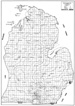 Map
B-2--Trenton Isopach Map
Map
B-2--Trenton Isopach Map Map
B-3--Black River Isopach Map
Map
B-3--Black River Isopach Map Map
B-4--Collingwood Shale Isopach Map
Map
B-4--Collingwood Shale Isopach Map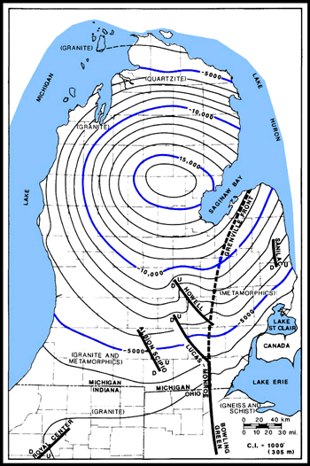
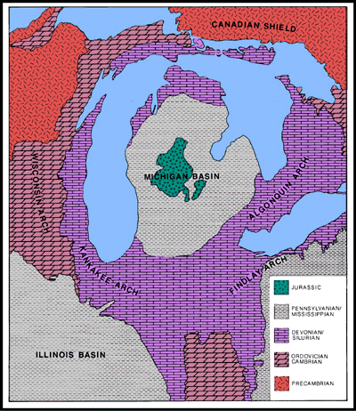