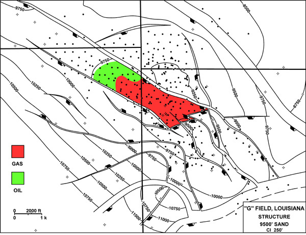
Figure 21. Structure map on top of the 9500 ft. sand showing its original distribution of oil and gas, “G” field coastal Gulf of Mexico, Louisiana.
Figure 21. Structure map on top of the 9500 ft. sand showing its original distribution of oil and gas, “G” field coastal Gulf of Mexico, Louisiana.