 Click
on image for enlargement.
Click
on image for enlargement.
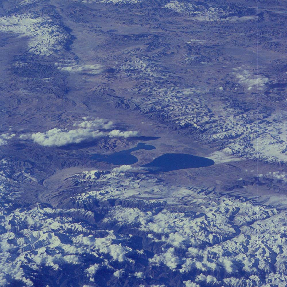
Figure 27. Photograph 33-72-078. Northwest along the right-lateral strike-slip Karakoram fault. In the center lie ‘Pear’ and ‘Champagne’ Lakes (real names: La’nga Co and Mapam Yumco, both 15,510 ft above sealevel, both closed basins). Extending the stem of the ‘glass’ across the valley to the snow-capped peak is Mt. Kailas, 21,770 ft, where Buddha is said to have risen to heaven from its peak.
The Indus River starts beyond the lakes and flows away from the viewer along the valley of the Karakoram fault to where it cuts through the mountains to the left. The Gilgit River starts near the lakes and takes the left valley to flow away from the lakes. The Brahmaputra heads to the right of the lakes and continues east for the length of the Himalaya in the valley formed by the suture zone.