 Click
on image for enlargement.
Click
on image for enlargement.
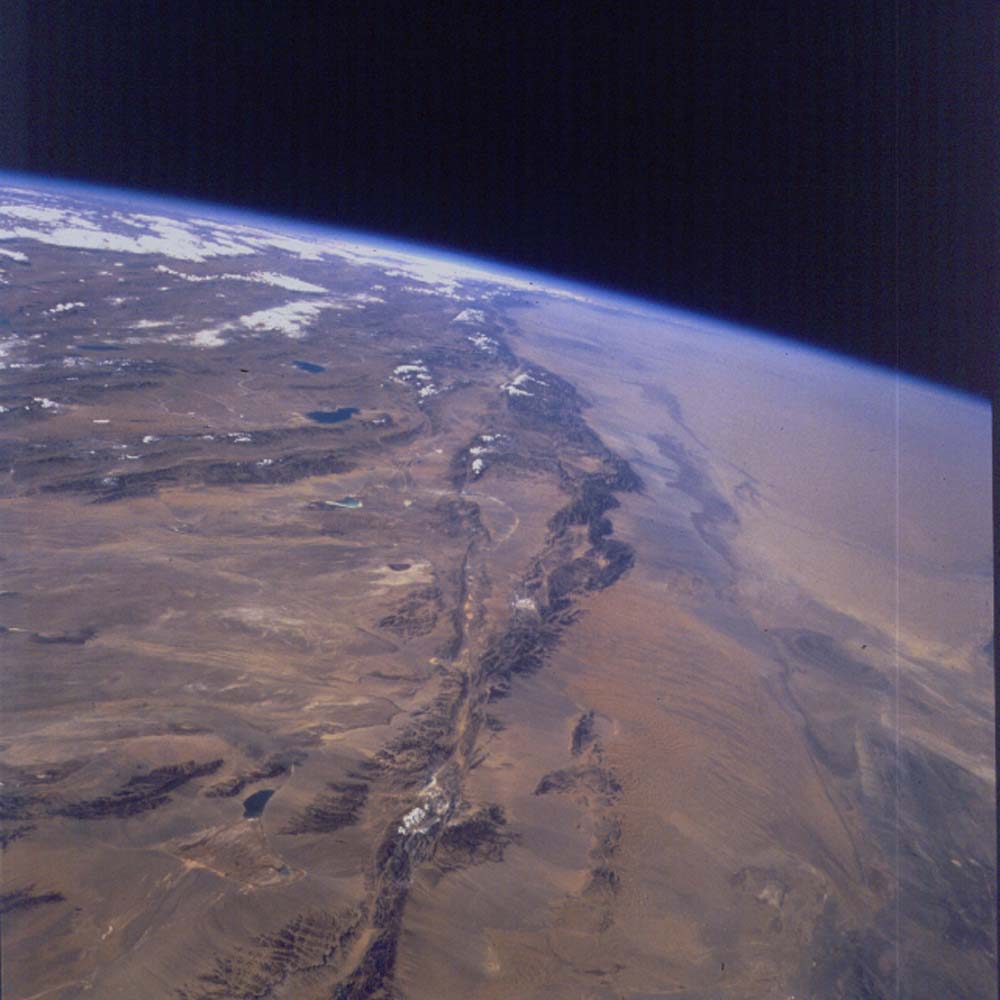
Figure 25. Photograph 66-95-083. West along the central segment of the 500-mile-long Altyn Tagh fault. It is the structural boundary between the Tarim Basin (right side) and the Tibetan Plateau (far left) and Qaidam Basin (near left). In near left the south branch of the Altyn Tagh fault turns to the left (southwest) to become the thrust front of the Tanghe Nan Shan ( highest peak- 18,540 ft). The north branch continues off the near edge of the photo for another 100+ miles. The lakes in the Qaidam Basin are about 10,000 ft above sea level; the distant lakes on the Tibetan Plateau are near 13,000 and 14,000 ft (farthest one) in elevation. The highest peaks along the Altyn Tagh fault exceed 19,000 ft in elevation.
The long, arcuate range to the right of the linear Altyn Tagh fault is bounded by thrusts as a result of being along a transpressional bend.
The Tarim Basin has its lowest elevation at Lop Nor, the dry lake basin with abandoned shorelines in the shape of an ear (at the right, near end of the sand desert).