 Click
on image for enlargement.
Click
on image for enlargement.
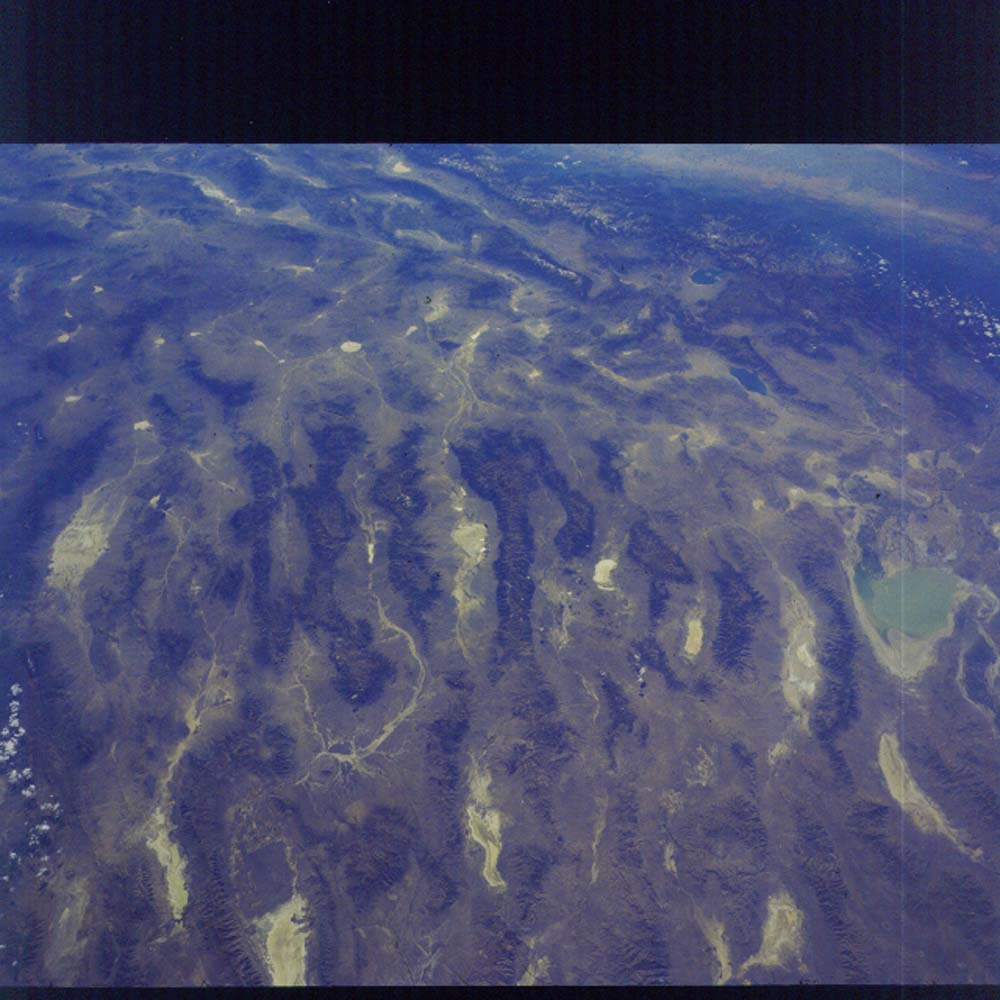
Figure 7. Photograph 17-121-184. Southwest across Nevada showing typical basin and range topography in foreground. South-trending ranges (mostly horst blocks) and intervening valleys (mostly graben) alternate as extension pulls them apart. Beyond they terminate against the Walker Line, a boundary that extends from Las Vegas to Reno. This marks the eastern boundary of a large triangular wedge. The western boundary is along the base of the Sierra Nevada (in the distance) and the Garlock fault (off the frame to the left) is the southern boundary. This triangular wedge has faults that move the far (west) side north parallel to the San Andreas fault (near the skyline) as well as normal faults that extend the region parallel to the Basin and Range Province faults. Mono Lake is nearly circular and lies at the base of the Sierra Nevada. Walker Lake lies to the right and in a valley closer to us.