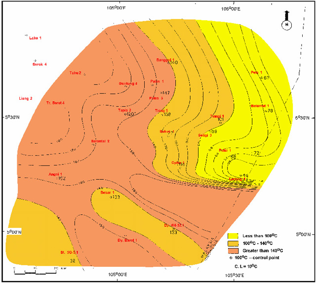
Figure 13--Map of postulated average formation temperature during maximum burial for Pulai-II sandstones, southern Malay basin. 'The values show a general correspondence basinal structure; the sharp gradient in the south coincides with a major fault zone.