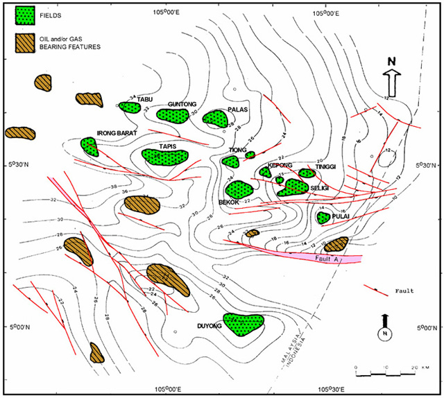
Figure 2--Structural map (hundreds of metres) of area of study in southern Malay basin on top of Pulai Sandstone (late Oligocene-early Miocene), as determined from seismic reflector B, with location of fields, hydrocarbon-bearing structures,and well control. Pulai, Bekok, Seligi, Kepong, and Tinggi produce from Pulai-II and younger Tapis sandstones.