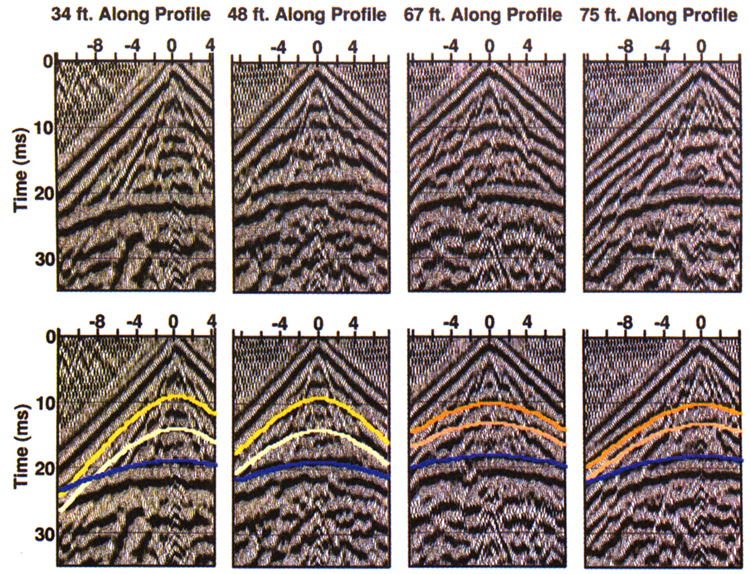
Figure 3. Four uninterpreted (top) and interpreted (bottom) representative field files from a recent ultra-shallow seismic-reflection survey near Great Bend, Kan. The horizontal axis is source-to-receiver offset in feet. The source was a single shot from a .22-caliber rifle, and the single-geophone group interval is two inches. Digital frequency and f-k filtering has been applied, as well as AGC scaling. The lateral distance from the shotpoint on the left to the shotpoint on the right is 40 feet. Within that distance, the weathering velocity changes from 518 ft/s to 682 ft/s, without noticeable surface topographic or soil variation. The event in blue is the water table, at a depth of eight feet.