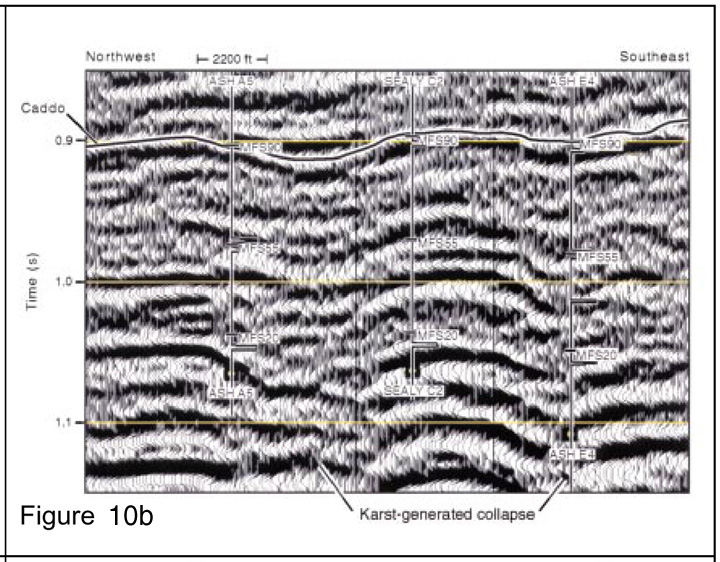
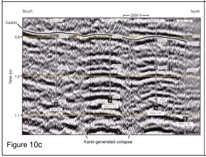
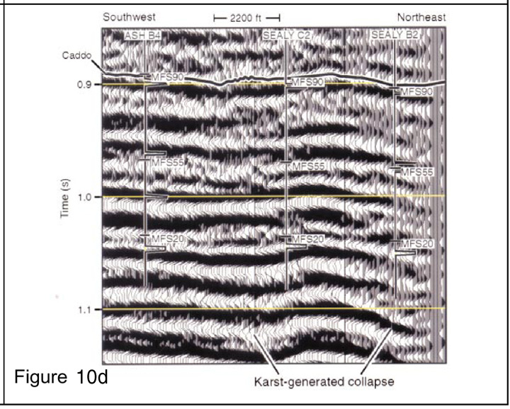
Click on particular seismic line (A, B, C, or D) to view it (Figure 10a, 10b, 10c, or 10d).
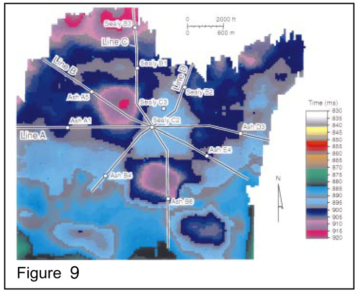
Figure 9. Time structure map of the Caddo in the vicinity of the Sealy C-2 well, which is positioned on a structural high that was created when surrounding strata sank into a ring of karst collapsed zones.