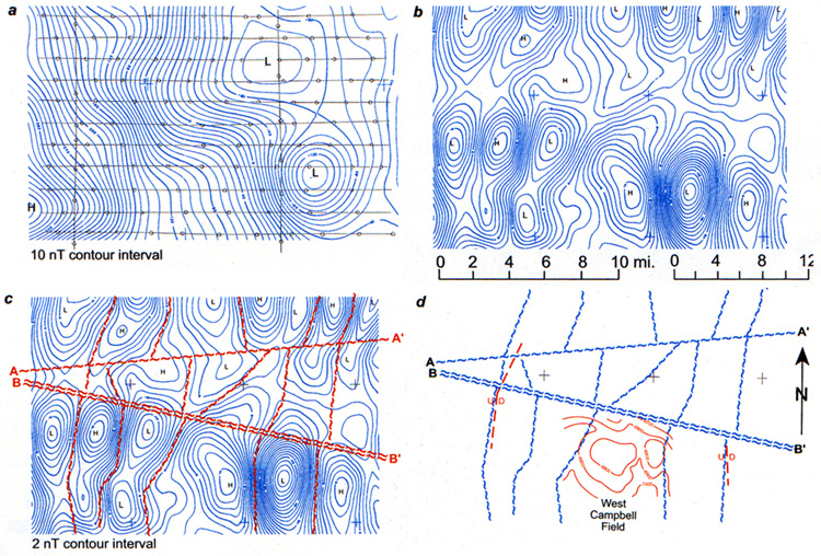
Figure 3. Example of basement mapping in Major and Woodward counties, Oklahoma, on north shelf of Anadarko Basin. Depth to basement - approximately 12,000 ft. (3,600m) beneath flight level.
a. Total intensity map - not generally useful in basement mapping. E-W flight lines are spaced one mile apart.
b. Flight line residual map of same data shown in 3a. This display maps the individual basement fault blocks.
c. Basement shear zones are drawn along boundaries between magnetic highs and lows, i.e. on gradients, and also along truncation lines (A-A. and B-B.).
d. Fault block interpretation, with known faults superimposed and with structure contours of an oil field superimposed.