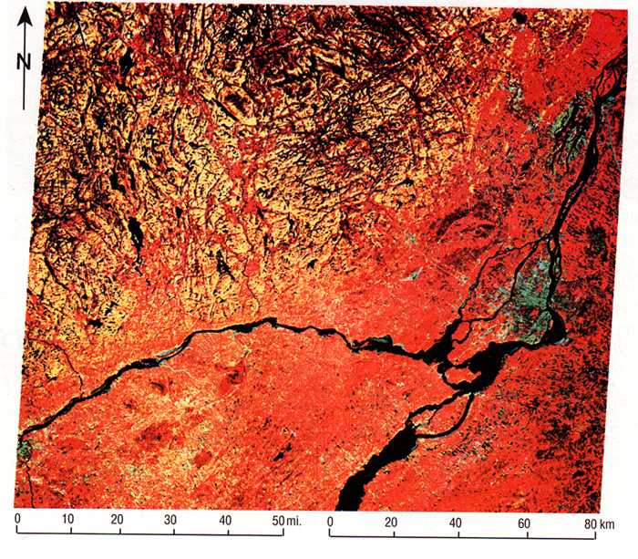
Figure 1. Landsat image of fractured and lineated outcrops of the Canadian Shield (yellow NW portion of image) and the onlap of lower Paleozoic rocks of the eastern Ontario - western Quebec Basin (red south and east parts of image) (from Lowman et al., 1992). City of Montreal, right center; St. Lawrence River runs from lower left center to northeast corner. The lineated basement terrane is not visible beneath the cover rocks but is mappable with properly processed and interpreted magnetic data.