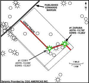
Figure 7--Map showing the outline of a three-dimensional seismic survey and the location of seismic line C of Figure 3. Line C is a user track from the survey that extends from the commonly recognized Edwards margin toward the southeast to the Chevron 1 Coby well, then easterly to the Exxon 1 Joe Zaruba well.