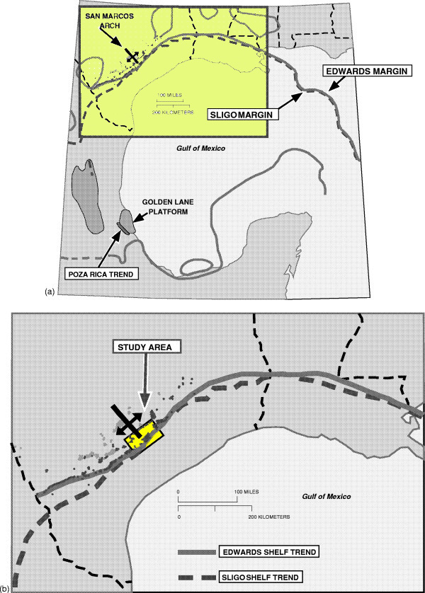
Figure 1--(a) Regional map of Gulf of Mexico delineating Cretaceous Edwards and Sligo margins in the northern portion and an undifferentiated margin in the south. Intrashelf basins and the San Marcos arch paleohigh are shown in the northern Gulf rim, as are two major isolated carbonate platforms in the south. (b) Detailed map of northern rim of the Gulf of Mexico showing the trend of the Cretaceous Edwards and Sligo shelf margins; the study area centered in Lavaca County, Texas; and Cretaceous production surrounding the study area. The shelf margins are generally portrayed in the literature as being coincident in the study area.