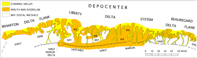
Figure 6. Depositional-environment map of a major regressive sequence of the Yegua Formation, middle Eocene of southeast Texas and southwest Louisiana, based on approximately 4,500 wells. The map was last updated in 1989, and was generated to predict downdip shelf-margin sands. The absence of shelf-margin deltas downdip of several channels is a reflection of well control at that time, as shown by subsequent drilling.