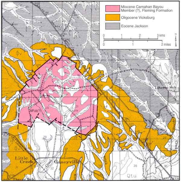
Figure 2 - Portion of Fisk's surface geologic map encompassing Little Creek structure (after Fisk, 1938). Following J.E. Rogers (1982; cf. Figure 7, and Snead and McCulloh, 1984), the central fill here is tentatively identified as Carnahan Bayou Member of the Fleming Formation rather than Fisk's original designation of the unit as Catahoula Formation. Quaternary units not listed in the legend comprise various Pleistocene terraces (white) and Holocene alluvium (stippled).