Click on any line below to link to that respective image.
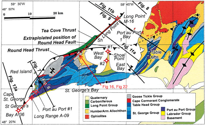
Figure 5. Surface geology of the Port au Port Peninsula and adjacent areas and locations of seismic and structural section lines. Based on data from H. Williams (1985), Stockmal and Waldron (1993), and Palmer (1995). The two Shoal Point wells are labeled #1 and #2.