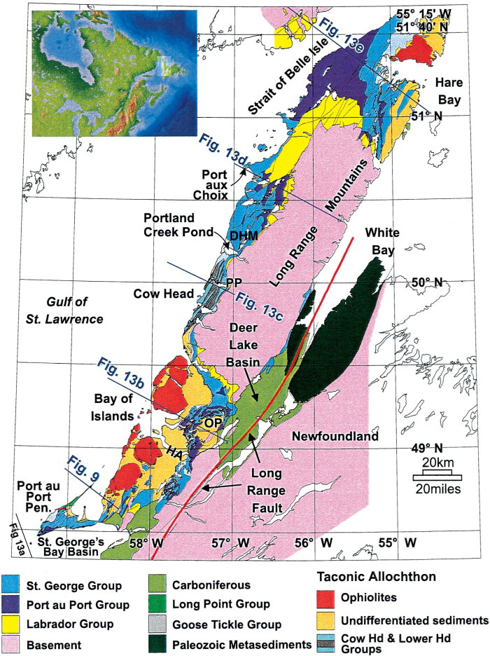
Figure 1. Surface geology compilation map of western Newfoundland based on work by Knight (1991, 1994), Stockmal and Waldron (1993), Palmer (1995), and H. Williams and Cawood (1989). The locations of regional structural cross sections are indicated. HA = Humber Arm; PP = Parson's Pond; DHM = Daniel's Harbour Mine; OP = Old Mans Pond.