Print this page
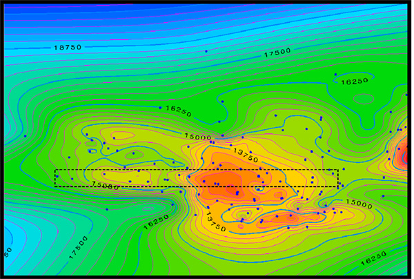
Figure 2.1: Map of Santa Barbara and location of wells used in the west-east 2-D projection (Figure 2.2).