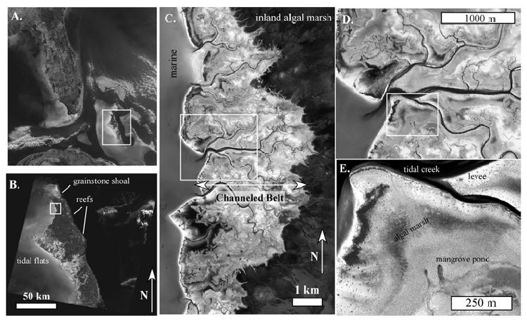
Figure 1. Multiple scales of heterogeneity, Bahamas platform. The nature and dynamics of heterogeneity at each of these scales is different. A. MODIS image, illustrating platforms and basins. B. Landsat image showing reefs on windward (east) side, tidal flats on leeward (west) flank of Andros Island. C. IKONOS image illustrating the shallow marine region to west, a channeled belt, and supratidal inland algal marsh to east. The channeled belt includes a complex mosaic of subfacies. D. IKONOS image illustrating details of the complex of creeks, levees, marshes. E. details of patterns in D. 1C-E are © Spaceimaging.com.