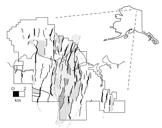
 Figure 1. Shallow fault map within the MPU and proposed pull-apart basin (light gray stipple). Regional structural dip is to the east. Fault segments with dip slip greater than 100 ft. are shown as bolder lines. Axial inline rhomb-shaped
half-grabens shown in dark gray. Grabens marked with stripe pattern. Unit boundary and coastline shown for reference.
Figure 1. Shallow fault map within the MPU and proposed pull-apart basin (light gray stipple). Regional structural dip is to the east. Fault segments with dip slip greater than 100 ft. are shown as bolder lines. Axial inline rhomb-shaped
half-grabens shown in dark gray. Grabens marked with stripe pattern. Unit boundary and coastline shown for reference.