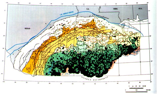
Figure 3-Structural summary map of the northern Gulf of Mexico Basin. Tectono-stratigraphic provinces are color coded as in Figure 2 and faults as in Figure 1.
Figure 3-Structural summary map of the northern Gulf of Mexico Basin. Tectono-stratigraphic provinces are color coded as in Figure 2 and faults as in Figure 1.