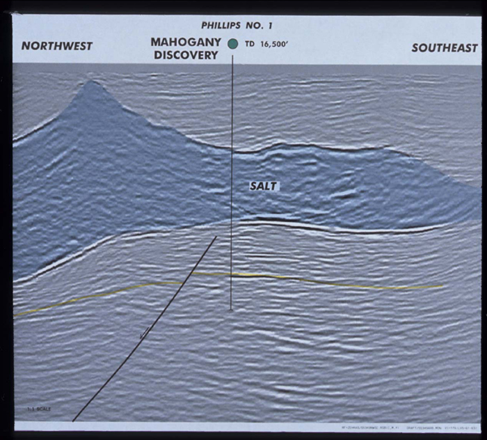
Figure 11. NW-SE seismic line. In the dip direction, the base of the salt dives to the northwest (towards the original source of the allochthonous salt). The northwest-dipping fault that cuts the anticline is clearly imaged on this daa. The top and base of salt are also imaged as well as the secondary diapir formed on this part of the salt sheet. This seismic line and the following line are from a Phillips pre-stack 3-D depth migration and have no vertical exaggeration.