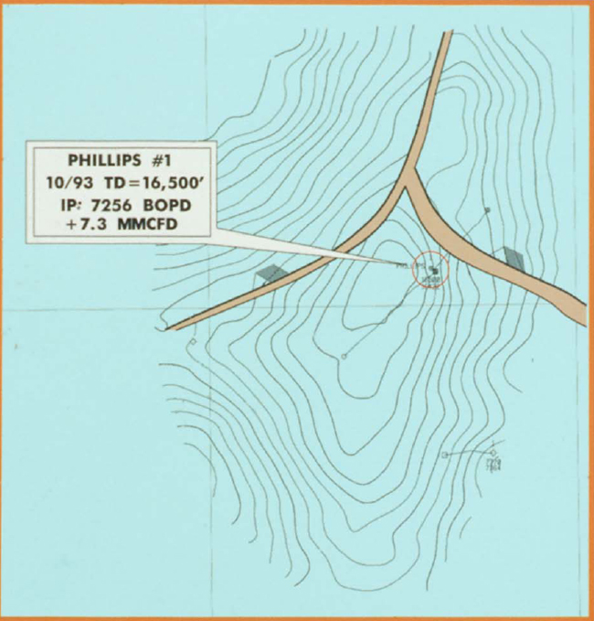
Figure 9. Depth structure map. Mahogany is basically a faulted anticline with 3-way dip closure. The discovery well was drilled four miles from the edge of the salt sheet. The detailed structure map shows only a generalized structure and interpretation of new data is ongoing. Also, the distribution of reservoir sand varies across the structure.