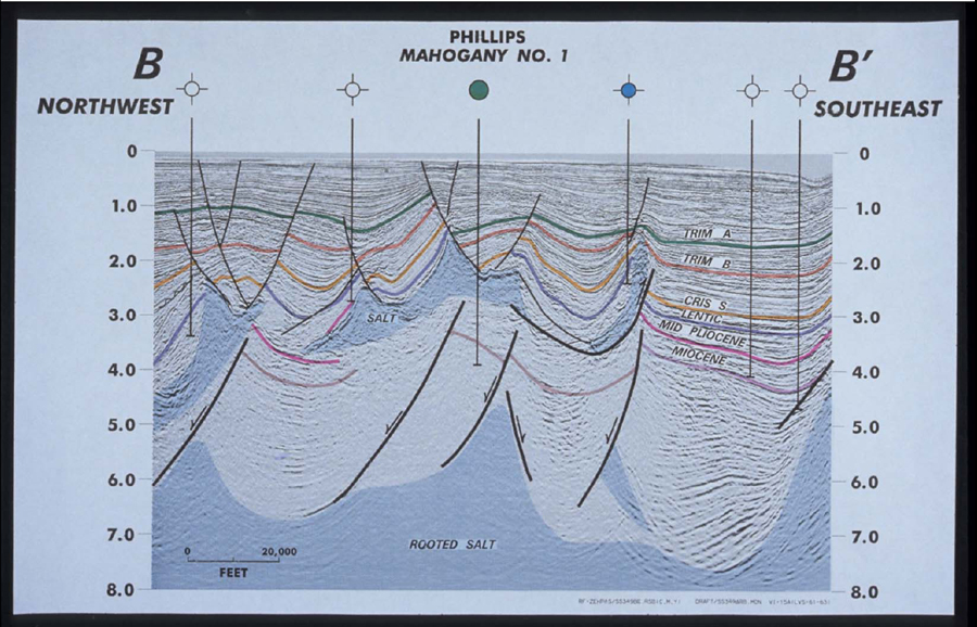
Figure 6. Seismic Line B-B’ runs from a deep basin in the SW to a deep basin in the NW. The Ewing Bank thrust terminates along this edge of the salt sheet system and emphasizes the separation of the structures above and below salt. Again, note the shallow well penetrations that test above salt structures only. Determination of sedimentary patterns in the deepwater slope environment is a function of paleobathymetric geometry. The deep salt highs will have acted as buttresses and deflected sand deposition as turbidite currents flowed down-slope. Slope sands are therefore sensitive to bathymetry and will concentrate into sand fairways. These two fairways are clear; it is this salt high which is critical to the Mahogany Prospect. The prospect is west of a deep salt high which deflected sand to form a fairway across the acreage.