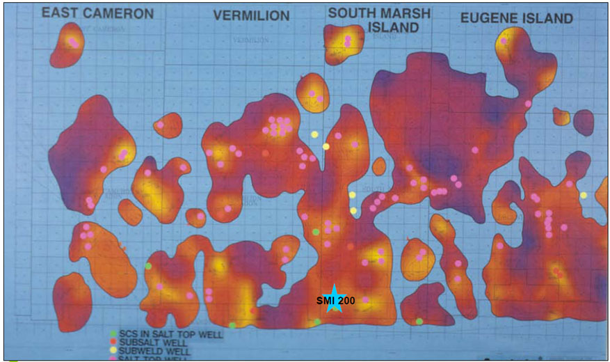
Figure 13. Index map of part of U.S. Gulf of Mexico (offshore Louisiana) to show location of South Marsh Island-200 (SMI 200), along with subsalt features and wells (after Moore and Brooks, 2009).
Figure 13. Index map of part of U.S. Gulf of Mexico (offshore Louisiana) to show location of South Marsh Island-200 (SMI 200), along with subsalt features and wells (after Moore and Brooks, 2009).