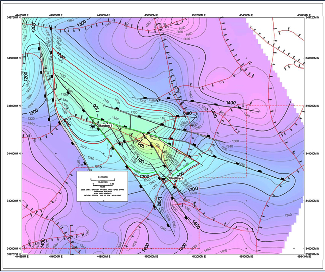
Figure 4. Base volcanic ash (top reservoir) depth (mss) map. Contour interval = 10 m. Polygons are used for estimates of gross rock volume, Green polygon = minimun AND mode area. Red = maximun area. The mapped up-dip potential for Strelley is > 120 m. Note Ilkeson 1 was a shallow well.