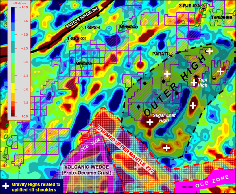
Figure 3. High-pass filtered Bouguer anomaly map (120 km) of the southern São Paulo Plateau showing the geographic relationship between the proto-oceanic crust wedge (southern Santos) and the Outer High, with its uplifted rift shoulders. The red area between the Outer High and the highly subsided proto-oceanic crust indicates a possible zone of exhumed upper mantle.