Click image to view enlargement.
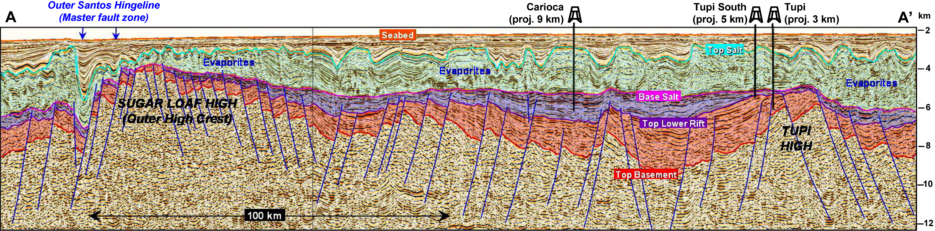
Figure 2. Regional interpreted seismic section across the Outer High of the Santos Basin, showing the Tupi and Sugar Loaf sub-highs, and the projected position of three key pre-salt wells (see Figure 1 for location). Note the thinning of both the syn-rift and sag sections against the basement culminations. The purple section, comprising upper syn-rift and sag, is expected to be dominated by carbonates. If not bald, the crest of the Sugar Loaf structure may be formed by Early Rift volcanic infill. Note also the “Outer Santos Hingeline”, a master fault region at the southeastern flank of the Outer High, showing a major throw at base salt level. The estimated ages for the horizons are: Top Salt ~122 my; Base Salt ~117 my; Near Top Lower Rift ~123 my; Top Basement ~132 my. (2D Wave Equation PSDM data used by kind permission of TGS)