Click on image to view enlargement.
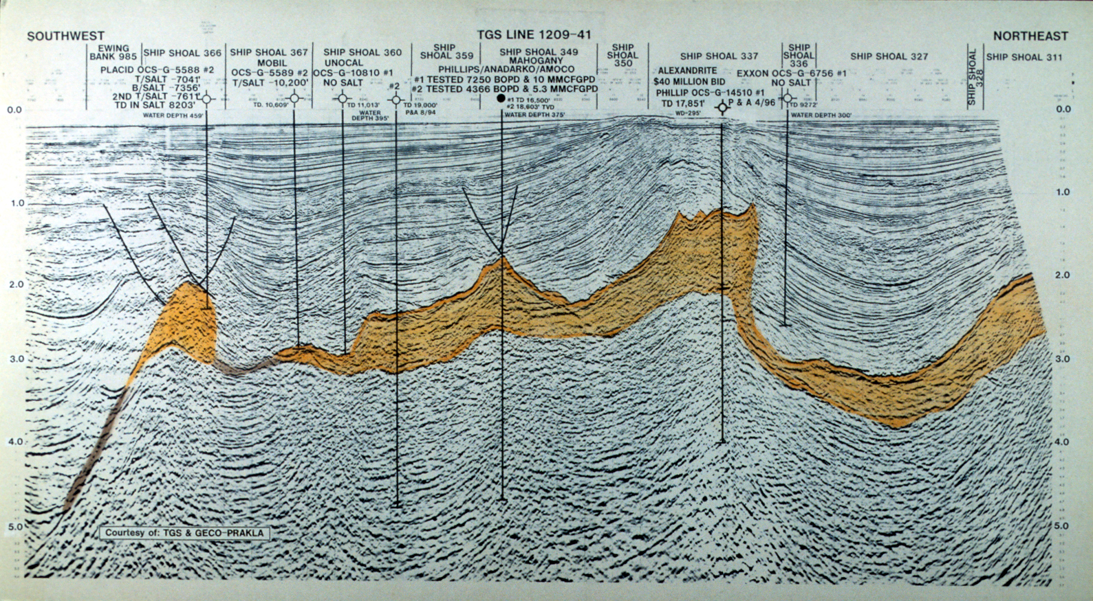
Figure 20. Southwest-northeast TGS seismic line 1209-41 through Ship Shoal 366 Placid #2, Ship Shoal 367 Mobil #2, Ship Shoal 360 Unocal #1 and #2, Ship Shoal 349 (Mahogany) Phillips/Anadarko/Amoco #1,#2, Ship Shoal 337 Phillips #1, and Ship Shoal 336 Exxon #1.