Click on image to view enlargement.
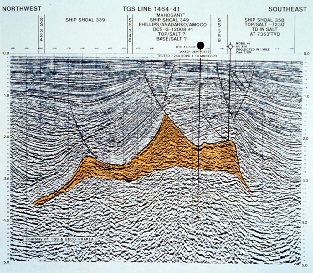
Figure 18. Northwest-southeast TGS seismic line 1464-41 through Ship Shoal 349 (Mahogany) Phillips/Anadarko/Amoco #1, and Ship Shoal 358 Mobil #1.
Click on image to view enlargement.
Figure 18. Northwest-southeast TGS seismic line 1464-41 through Ship Shoal 349 (Mahogany) Phillips/Anadarko/Amoco #1, and Ship Shoal 358 Mobil #1.