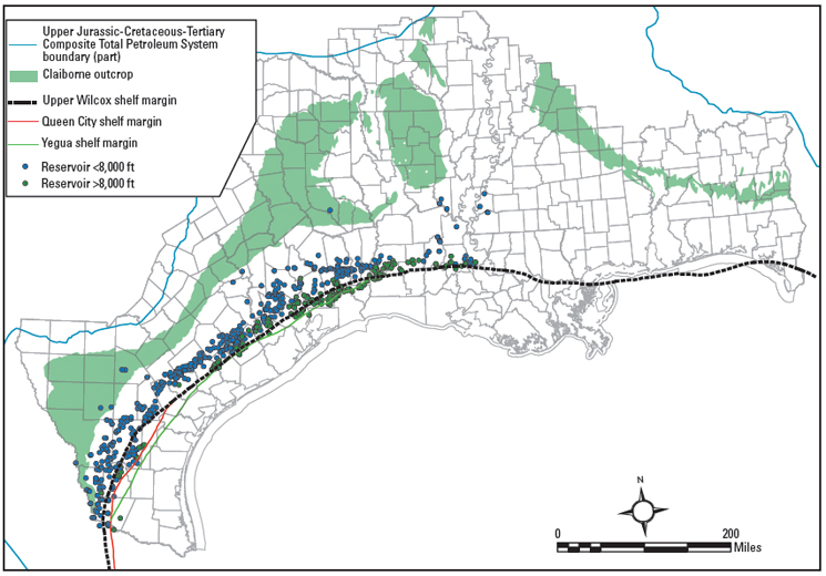
Figure 25. Spatial distribution of Claiborne reservoirs <8,000 ft depth-to-top and >8,000 ft depth-to-top. Note that latitude and longitude are not shown and that the locations of the reservoirs have been shifted slightly to alter their exact location due to proprietary license restrictions on the NRG Associates (2006) database. Claiborne Group outcrop from Schruben et al. (1994); Wilcox and Claiborne shelf margins from Galloway et al. (2000).