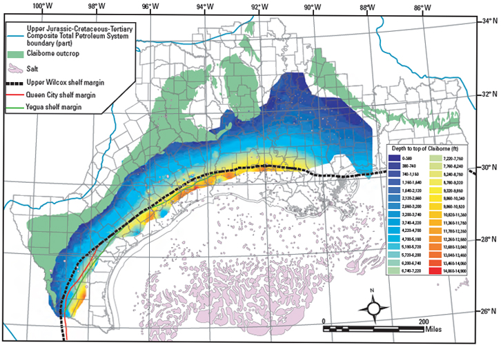
Figure 5. Depth to the top of Claiborne (Yegua Formation) constructed from the IHS Energy Group (2005) database, and from the Paleo-Data, Inc. (1989) Tenroc Regional Geologic database. Tops data were combined with paleontologic data in ArcMap 9.1 (Environmental Systems Research Institute, Inc), and a kriging process step was used to create a surface grid for formation tops. The top surface grid was subtracted from the elevation at surface to create the depth-to-top grid. Claiborne Group outcrop from Schruben et al. (1994); salt from Ewing and Lopez (1991); shelf margins from Galloway et al. (2000).