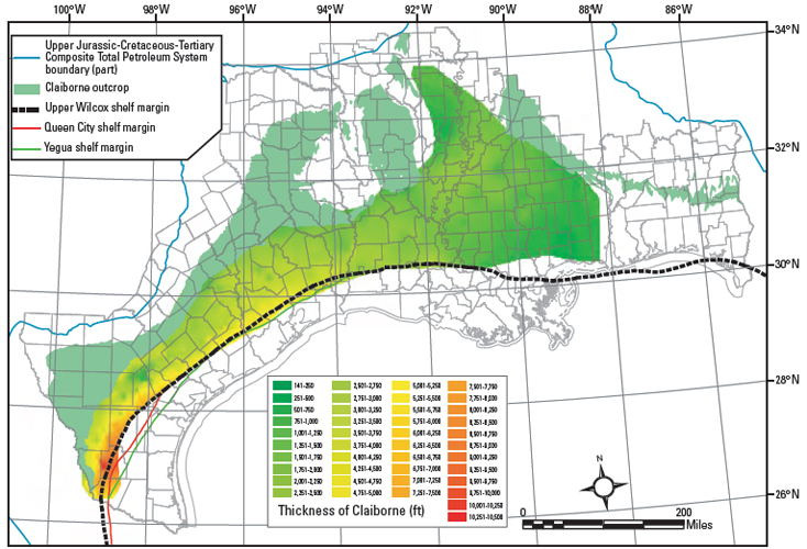
Figure 4. Claiborne isopach map constructed from the IHS Energy Group (2005) database, and from the Paleo-Data, Inc. (1989) Tenroc Regional Geologic database. Tops data were combined with paleontologic data in ArcMap 9.1 (Environmental Systems Research Institute, Inc), and a kriging process step was used to create a surface grid for formation tops. Isopach thicknesses were determined by subtraction of surface grids or by the subtraction of individual data points where sufficient tops data were present in the databases. There are no tops data available from the longitude of Mobile Bay eastward.