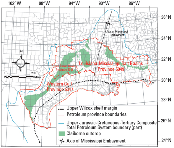
Figure 1. Map of Gulf Coast states, showing petroleum province boundaries, outline of Upper Jurassic-Cretaceous-Tertiary Composite total petroleum system (in part), Claiborne Group outcrop (from Schruben et al., 1994), and the Upper Wilcox shelf margin (from Galloway et al., 2000).