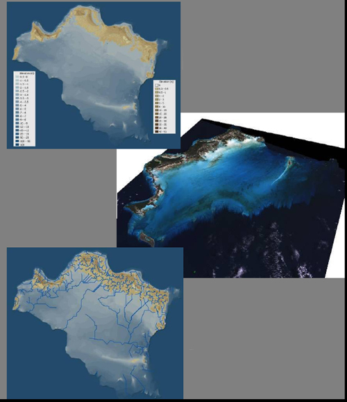
DEM and examples: Upper: Offshore and onshore DEMs merged in GIS and color-coded with elevation or water depth in meters. Middle: Perspective view looking ENE of 1990 Landsat TM image draped onto DEM (50X vertical exaggeration). Lower: Drainage map showing pruned (low density) network derived from onshore + offshore DEM.