Click to
view article in PDF format.
Click to
view article in PDF format.
3D Seismic on Surmont – Improving Resources and Risks Assessment*
By
Denis Druesne1, Richard Shang2, and Bryan Vandal2
Search and Discovery Article #40280 (2008)
Posted March 27, 2008
*Adapted from extended abstract prepared for AAPG Hedberg Conference, “Heavy Oil and Bitumen in Foreland Basins – From Processes to Products,” September 30 - October 3, 2007 – Banff, Alberta, Canada
1Total EP Canada seconded to ConocoPhillips Canada, Calgary, AB
2ConocoPhillips Canada, Calgary, AB
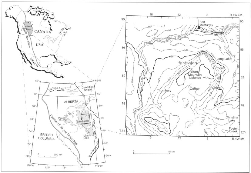
Located within the Athabasca basin, the resources in the Surmont lease (Figure 1) are currently estimated to approximately 20 Bbbl of bitumen in place. The Surmont project will develop the oil sands (~8 API) by the means of the Steam Assisted Gravity Drainage process (SAGD). SAGD development projects for oil sands are characterized by a large number of horizontal wells required to maintain a production plateau of ~30 years.
The reservoir, located within the McMurray Formation (Albo-Aptian), is primarily made of unconsolidated sandstones deposited in a fluvio-estuarine environment with high facies variability. As for most development projects in the Athabasca oil sands the resource evaluation historically relied on the delineation wells with very limited seismic input. The interpolation of well information in this highly heterogeneous reservoir environment remains a challenge, especially when dealing with a relatively low well density.
|
|
From a subsurface viewpoint, the challenges are numerous; three of them are particularly relevant:
The Surmont database consists of 415km2 (two third of the Lease area) of high quality 3D seismic data acquired over 5 winters. The seismic imaging quality is fair but the interpretation remains challenging (Figures 2 and 3), mainly due to: · The seismic resolution and the lack of velocity contrast between lithologies (shale and sand). · The complex geological environment: high facies variability. · The complex fluid distribution (gas and water over bitumen) together with a limited knowledge of the petroelastic behavior of the bitumen.
The only obvious seismic horizons to define the McMurray reservoir are the Wabiskaw/McMurray marker and the Devonian Unconformity marker. The seismic signal within the reservoir is complex and corresponds to a mix of discontinuous reflections associated with lithological variations and/or fluid effects that are difficult to differentiate
The integration of conventional well logs, high resolution electric imaging, geological core, and seismic information has led to: · Better resources and risks categorization assessment. · Reducing uncertainties. · Improving reservoir models, therefore well performance predictability
In this presentation we offer an interpretation and integrated methodology developed on Surmont to enhance resources / risks mapping and to better understand the McMurray reservoir architecture to optimize bitumen recovery. The interpretation does not require “rocket-science technology.” It remains pragmatic and relied strongly on data integration.
Barson, D., Bachu, S., Esslinger, P., 2001, Flow systems in the Mannville Group in the east-central Athabasca area and implications for steam-assisted gravity drainage (SAGD) operations for in situ bitumen production: Bulletin of Canadian Petroleum Geology, v. 49, p. 376-392.
|