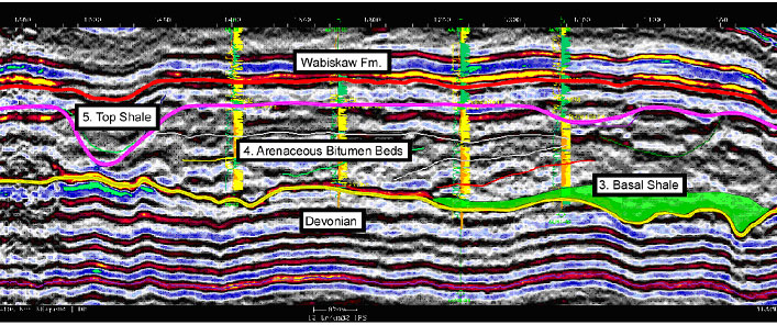
Figure 3. Random seismic line through the Surmont area, annotated with the identified palyno-chronostratigraphic units calibrated to seismic interpretations. Lowermost units 1 and 2 are not present. The Basal Shale (in shaded green) is locally present in low-lying topography immediately above the Devonian unconformity (in yellow). Thick bitumen-saturated arenaceous beds are predominant: note the interpretation of the inclined reflectors possibly representing tidal channels. Such a determination would be confirmed by the presence of low-salinity (brackish) dinoflagellates in the corresponding palynofloral assemblages. The Top Shale (in pink) is locally thick, cutting down almost to the Devonian unconformity. The entire region is then unconformably overlain by strata of the Wabiskaw Formation (in red).