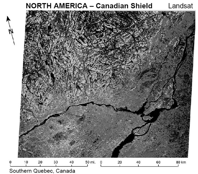
Figure 28. The northwestern portion of the Landsat image shows an area of outcropping basement of the Canadian shield that is cut by several zones, such as those occurring under the Powder River Basin. All the Earth’s shields and all the cratons are similarly cut by these long, through-going weakness zones. The eastern and southern parts of this image are covered by Lower Paleozoic rocks of the Ontario Basin, which hide the basement rocks. From Short et al., 1976, p. 194.