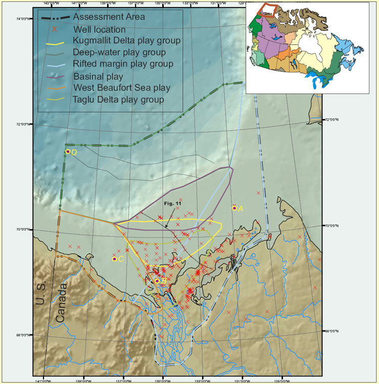
Figure 1. Location map shows the study area of the assessment, play group boundaries and exploratory wells in the province. The red polygon in the inserted map of Canada (upper-right) indicates the location of the Beaufort/Mackenzie area. A, B, C, and D indicate the well locations of 1D modeling of Figure 6.