Click on image to view enlargement.
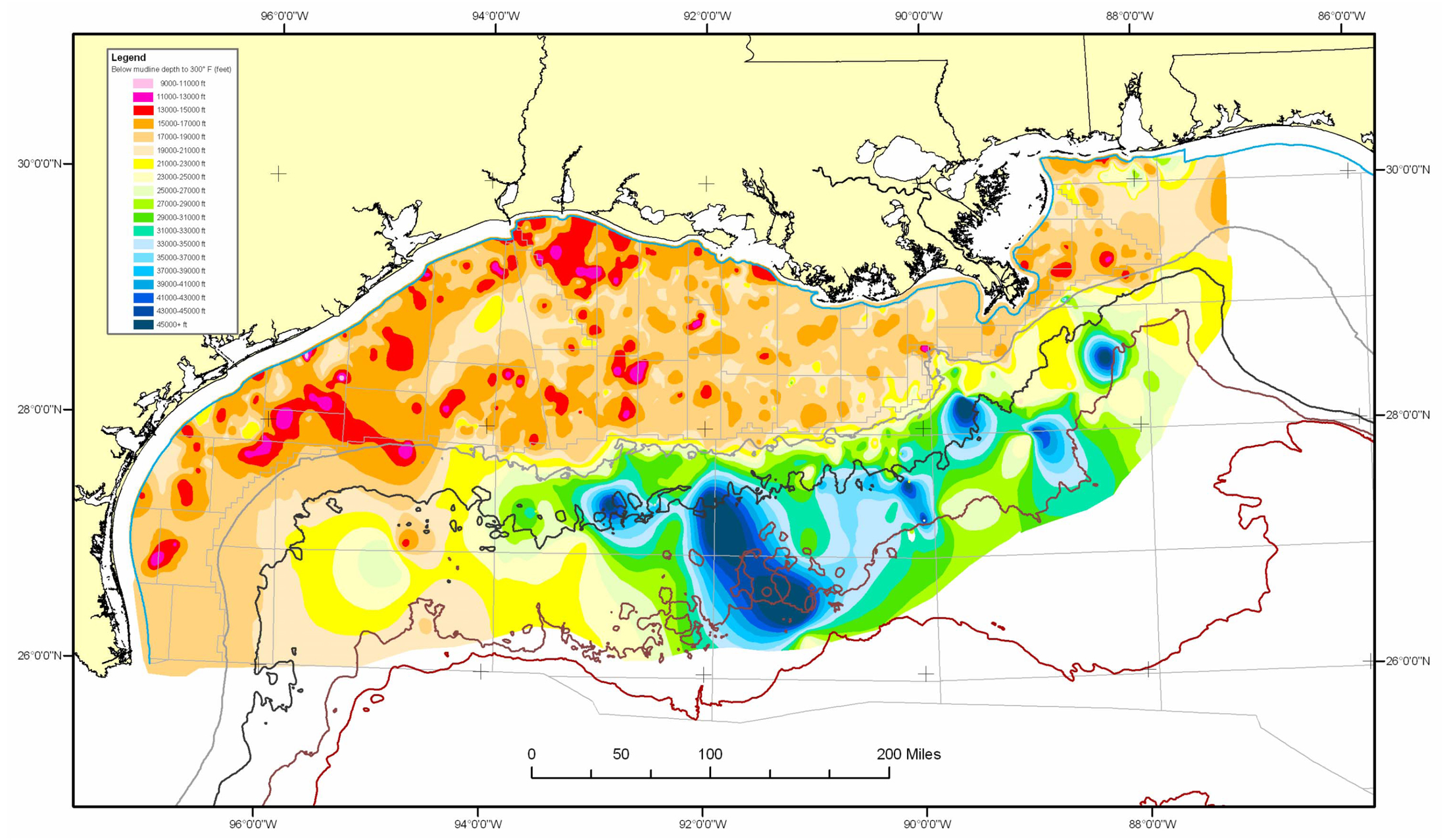
Figure 8. Map of interpreted below-mudline depths to 300oF (BMLD300). areas in the Gulf of Mexico. See Table 1 for summary of data and key to protraction area abbreviations.
Click on image to view enlargement.
Figure 8. Map of interpreted below-mudline depths to 300oF (BMLD300). areas in the Gulf of Mexico. See Table 1 for summary of data and key to protraction area abbreviations.